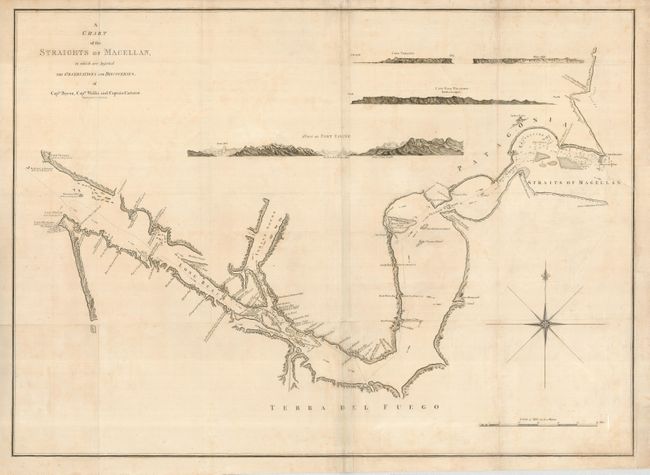
"A Chart of the Straights of Magellan, in which are Inserted the Observations and Discoveries of Cap.tn Byron, Cap.tn Wallis and Captain Carteret", Russell, John C.
Subject: South America - Southern
Period: 1768 (circa)
Publication:
Color: Black & White
Size:
31 x 22.2 inches
78.7 x 56.4 cm
Striking large-scale chart showing the Straits of Magellan and the Patagonian coast with detailed shoreline topography. Channels, soundings, shoals, harbors, islands and anchorages are all detailed. Four finely engraved views are incorporated at top: Cape Virgins; White Cliffs; Cape Fair Weather; and A View of Port Famine (Puerto Hambre). The chart includes a large compass rose and depicts the discoveries of the British navigators, Byron, Wallis and Carteret.
References:
Condition: B+
A good impression on a sheet with folds as issued. The right binding side has a repaired tear that enters about 1.5" into map, and paper has been added to the margin to facilitate framing. Tissue reinforcements are present on some of the folds on the verso.