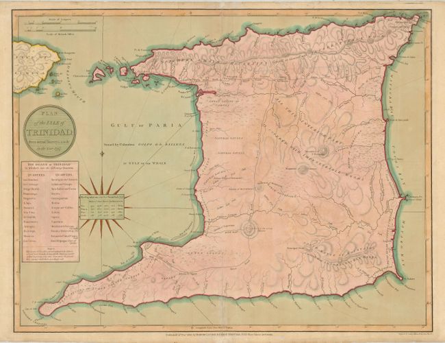
"Plan of the Isle of Trinidad, from Actual Surveys made in the Year 1797", Laurie & Whittle
Subject: Trinidad
Period: 1800 (dated)
Publication: A New & Elegant … Atlas
Color: Hand Color
Size:
25 x 19.5 inches
63.5 x 49.5 cm
A large, scarce plan of the island of Trinidad with a chart at the left showing the 28 quarters that the island was divided into at the time. The Mountain of Tamana is portrayed within the interior, noted as being 'covered with impenetrable woods.' A number of foot paths and roads are noted including the Royal Road and the Indian Road. The information for the map was taken in 1797, the year the British raided this Spanish possession and turned it into a colony of Britain. A small chart centered on the compass lists the population of the island in 1797 including the populations of slaves, whites, and Indians, all subdivided by gender and age. Engraved by George Allen.
References:
Condition: B
Original color on a sheet with some irregular toning. The centerfold has extraneous creasing and some separation, repaired on the verso and the lower recto with tissue. The blank margins have some tissue repairs on the verso.