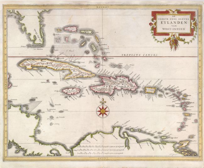
"De Groote ende Kleyne Eylanden van West-Indien", Gerritsz/De Laet
Subject: Caribbean
Period: 1630 (published)
Publication: Nieuwe Wereldt ofte Beschrijvinghe van West-Indien…
Color: Hand Color
Size:
14.2 x 11 inches
36.1 x 27.9 cm
This map covers all of the West Indies and the Bahamas and shows the coastline of the Florida peninsula, Central America and northern South America. The title is contained in a decorative title cartouche and the map is further embellished with a compass rose. The map is the work of Hessel Gerritsz, one of the truly important Dutch cartographers of the 17th century. Gerritsz was cartographer to the Dutch East India Company and De Laet was the director of the Dutch West India Company. Most of Gerritsz' work was only done in manuscript and these maps, published by De Laet, are the only Gerritsz maps available to the collector today.
References:
Condition: B+
There are a couple insignificant printer's creases and light stains, else very good. The top margin has been professionally extended, using the leaf-casting method, to better accommodate framing with a few lines of facsimile in the neatline.