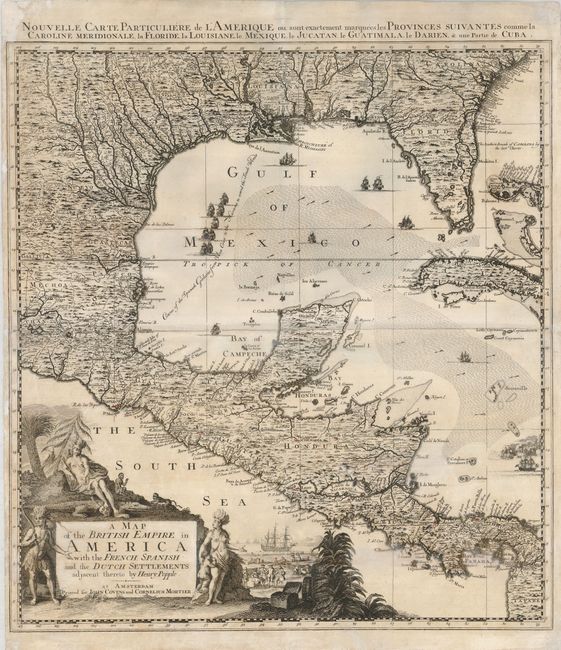
"A Map of the British Empire in America with the French, Spanish and the Dutch Settlements adjacent thereto by Henry Popple", Popple/Covens & Mortier
Subject: Colonial North America and West Indies
Period: 1742 (circa)
Publication:
Color: Black & White
Size:
20.8 x 23.5 inches
52.8 x 59.7 cm
This is the lower left sheet of Covens & Mortiers four-sheet reduction of Popple's 20-sheet map of North America. The detail is finely engraved with scores of cities and towns, as well as minute topography. The map is richly embellished with a title cartouche featuring Native Americans, monkeys, a crocodile and a scene of European traders in the background. There are numerous fine sailing ships and the course of the Spanish galleons from Vera Cruz to Havana is identified. This example is a variant with the word 'Hollandish' replaced by 'Dutch' in the title. French title across top: Caroline Meridionale, la Floride, la Louisiane, le Mexique, le Jucatan, le Guatimala, le Darien, & une Partie de Cuba.
References: cf Cumming (SE) #231; McCorkle #741.2.
Condition: B
A good impression on a sheet with a miss-fold resulting in a crease in the center. There is a repaired tear in the bottom of the map that enters 2" into the map and one on the left portion of the centerfold that enters about 1.5" into the map. A few spots of toning, still a nice map that presents well.