Catalog Archive
Auction 124, Lot 293

"Map of Harris County Texas from Land Office of A.C. Swanson & Co.",

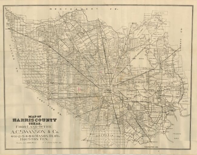
Subject: Texas, Harris County

Period: 1910 (circa)

Publication:

Color: Black & White

Size:
26.5 x 20.5 inches
67.3 x 52.1 cm
Download High Resolution Image
(or just click on image to launch the Zoom viewer)

A great map detailing the land holders of Harris County, centered on the city of Houston. The map shows all land parcels in the region on a scale of 1 inch = 4500 Varas. It extends to include the surrounding region to show League City, Red Bluff, Cedar Bayou, Huffman, Porter, Spring, Waller, Katy, Clodin, and Duke. Landowner's names are noted on the parcels. All roads and railroads in the region are shown. This great ephemeral map was issued by the Land Office of A. C. Swanson and Co., and was drawn by T. C. Edminster. An uncommon issue.

This map is dimensioned in the unique Texas measurement unit of vara, carried forward from the Spanish and English measures. Originally, colonial Spanish surveying was done with the cordel, or 50 varas long. Because of different methods employed by early settlers from the United States the vara varied between 33-1/3 and 33.4 inches. This disparity remained until the Texas vara was legally set at 33-1/3 inches by the Texas legislature in 1919.

References:

Condition: B+

The map has folds as issued, with some minor fold intersection splits. There is a little irregular toning and some pink marks used to identify three parcels. Dark impression and full margins.

Estimate: $140 - $180

Sold for: $500

Closed on 5/7/2008

Archived