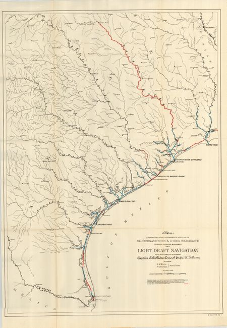
"Map Showing Relative Geographical Position of San Bernard River & Other Waterways", U.S. Army
Subject: Texas
Period: 1899 (dated)
Publication: HR Doc 446, 56th Congress, 1st Session
Color: Printed Color
Size:
19.8 x 28.5 inches
50.3 x 72.4 cm
A scarce map produced by the Army Engineers showing channel improvements to aid navigation. The map is focused on the coastal region, and it extends along the coast from Brownsville to Sabine Pass. It includes the interior to above Dallas and locates Brazos Santiago, Arkansas Pass, Pass Cavallo, Houston, Shreveport, San Antonio, and other towns. Red and blue overprinting indicates status of navigable channels and plans for dredging. Prepared by Capt. C.S. Riche, Corps of Eng'rs. U.S. Army, assisted by S.M. Wilcox and F. Opikofer, December 1899.
References:
Condition: A
Folding as issued. Near fine example with the slightest line of toning along one fold.