"Preliminary Chart of Charleston Harbor and its Approaches…", U.S. Coast Survey
Subject: South Carolina
Period: 1856 (dated)
Publication:
Color: Black & White
Size:
32 x 30 inches
81.3 x 76.2 cm
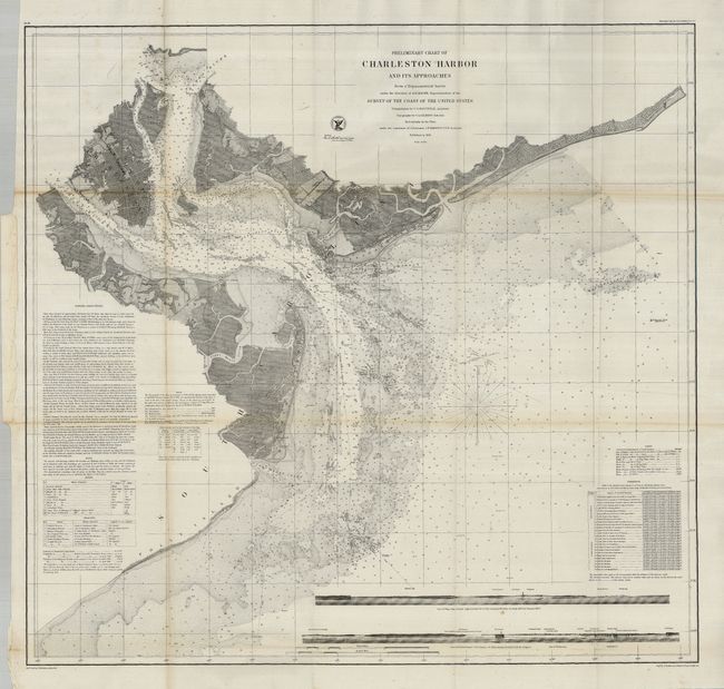
This fine chart of Charleston Harbor extends to show Charlestown and further inland to the confluence of the Cooper and Wando Rivers and part of the Ashley River. It locates the forts of Sumter and Moultrie. It includes soundings, navigational channels, hazards, beacons and lighthouses. For a coastal chart, the inland detail is remarkable with plans of Charleston, Mount Pleasant and Moultrieville, plus land and rivers delineated. St. Michaels and St. Phillips are named in Charleston and the light ship at Rattlesnake Shoals is noted. Two sea views at bottom show the coastline as seen from onboard an approaching vessel.
References: Stephenson (CW) 383.
Condition: A
Folding, as issued. Considering the condition of most coastal survey charts this example is near fine. One fold has some very minor toning.