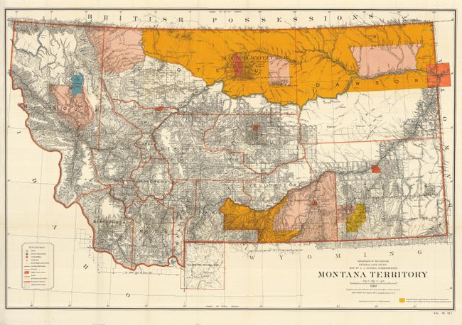
"Montana Territory", General Land Office
Subject: Montana
Period: 1887 (dated)
Publication: Senate Doc. 58, 52nd Cong., 1st Sess.
Color: Printed Color
Size:
38.8 x 26 inches
98.6 x 66 cm
This is the large edition that shows in great detail the extent of public surveys in Montana at this time in its history - it was admitted as a state in 1889. Hydrology and topography are well developed on this colorful map. The map shows Indian reservations (Blackfeet, Flathead etc.); military posts (Forts - Assiniboine, Keogh, Maginnis, Custer, Camp Baker, etc.); completed and proposed railroads; locates Custer Hill, Custer's Monument, and the Reno battlefield; and shows Yellowstone National Park in its entirety with major features. Remarkable detail throughout on a scale of 1 inch to 15 miles. Extensive legend identifies land offices, Surveyor Generals Office, county seats, towns, villages and railroad stations, railroads, military reservations, Indian reservations, railroad land grant limits, etc.
References:
Condition: B
A bright example that has some edge tears and chips, and some fold separations, one entering the map about 4" at top. This would benefit greatly by some simple conservation.