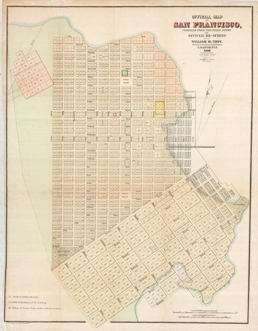
"Official Map of San Francisco, Compiled from the Field Notes of the Official Re-Survey…", Eddy, William M.
Subject: California, San Francisco
Period: 1849 (dated)
Publication: Senate Ex Doc 18, 31st Congress 1st Session
Color: Hand Color
Size:
19.5 x 25 inches
49.5 x 63.5 cm
This is an early city plan of San Francisco. Planned tracts extend into the bay depicting the areas of landfill extension. The map provides excellent detail, including individual numbered lots and many street names. Some of the locations identified include the Yerba Buena Cemetery, a Government Reserve, two public squares, and Fort Montgomery, but no buildings are shown. There is a colored key at lower left listing a grant to Senora Briones, the claims of the heirs of Col. J. A. King and a claim of Senor Pana under a Mexican Grant. Two distance scales at the lower right measure Mexican varas and English feet. Attributed by Howes to the report, "Land Titles in California" by William C. Jones. An early view of the city that was drawn by S. W. Higgins and printed by C.B. Graham.
References: Howes #E-248.
Condition: B
Issued folding, now flattened. Paper has been added to the lower left binding side with a small amount of the neatline reinstated in facsimile. A repaired tear enters the map about 1.5" on the left.