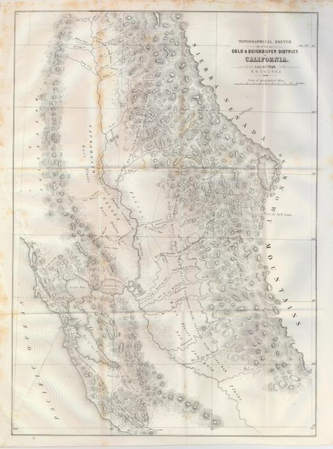
"Topographical Sketch of the Gold & Quicksilver District of California", Ord, E. O. C.
Subject: California
Period: 1848 (dated)
Publication:
Color: Black & White
Size:
15.5 x 21.5 inches
39.4 x 54.6 cm
This is considered one of the most important maps of 1848. It accompanied the first official report of the gold discoveries and was the first map to reflect actual conditions at the mines, thus being of paramount importance to the California Gold Rush. It shows in detail the area south of San Francisco Bay (the Quicksilver area), across the Sacramento Valley and San Joaquin Plains and east to Lake Tahoe (here called Mountain Lake). Notes indicate were gold was to be found throughout the region. An important Gold Rush map that was lithographed by P.S. Duval of Philadelphia.
References: Wheat [Gold] #54 & [TMW] #565, Schwartz & Ehrenberg p. 278-9.
Condition: B
Folding, as issued. A nice example with full margins, bright paper, full margins and a good impression less some foxing along a couple folds.