"Message from the President of the United States ... in Relation to California and New Mexico, Senate Document 18, 31st Congress, 1st Session, Vol. 9.", U.S. Government
Subject: California and Mexico
Period: 1850 (dated)
Publication:
Color: Black & White
Size:
6 x 9 inches
15.2 x 22.9 cm
Interesting report concerning California and Mexico following the treaty of Guadeloupe Hidalgo. The report contains seven maps and sketches including two important maps relating to the California Gold Rush:
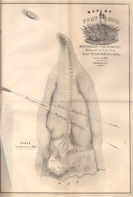
1) Map of Fort Hill Monterey California is full of topographical information. It locates the fortified Monterey Redoubt, the Old Mexican Fort, and the claims of Doyle, Shubrick, Bailey, Spence and Little. Military themed engraving in title. Lithographed Ackerman, New York.
2) Untitled sketch of the entrance to San Francisco Bay shows the Presidio near Punta del Castillo. Yerba Buena and Sausalito are located.
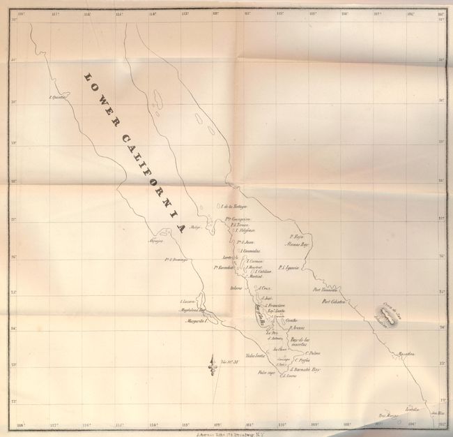
3) Untitled map of Lower California shows the cities of Mazatlan and Cabo San Lucas, and the Bay of La Paz.
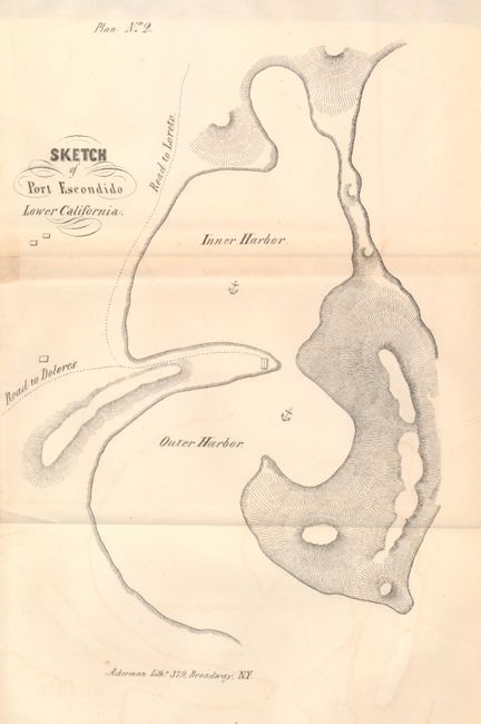
4) Plan No.2 Sketch of Port Escondido Lower California shows anchorages and the roads to Dolores and Loreto.
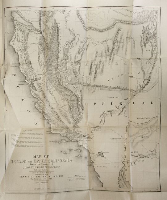
5) Map of Oregon and Upper California from the Surveys of John Charles Fremont... This is the smaller version of Fremont's highly respected map of the West. The map covers a smaller area than his larger map of the same title, eliminating Oregon, and covering only the western parts of present-day Arizona and Utah. El Dorado or Gold Regions are shown on the south fork of the American River and the upper course of the Feather River. The map includes a notation identifying the location of Mormon settlements for the first time, and shows Fremont's famous topographical error, an east-west mountain range across the unexplored area of the Great Basin.
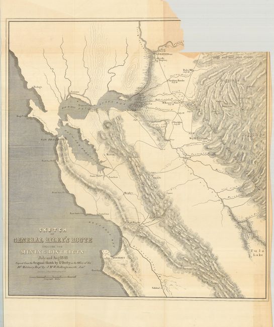
6) Sketch of General Riley's Route Through the Mining Districts July and Aug. 1849. This important map was made from the original sketch by Lt. Derby in the office of the 10th Military Dept. It is historically important, not only for its depiction of Gen. Riley's route, but because it names, for the first time, certain actual mining camps in the middle Sierra foothills; Mormon Island (misspelled Mormont), Coloma (mislabeled Colluma), Curtis, Sullivan's, Corons, Jamestown, Woods and Sonora. The entire route of the Riley party is noted, with the dates of their visits to the various camps, and covers the region from Monterrey Bay, north to Sacramento and east to the gold diggings.
7) Plan of the Route of the Expedition of Major Beall, 1st Drag's for the Relief of the Wagons of Mr. F.X. Aubrey against the Apache Indians. Small map of the region from Santa Fe to Bent's Fort. With topography shown by hachure.
References: Howes #C-53; Wagner Camp #179b-1.
Condition: C+
Map #6 is loose, having been torn from the binding edge across the upper left corner. The rest of the maps have some uneven toning, occasional foxing, and minor offsetting. The back cover is detached, and the front cover is nearly detached. The spine has some cracking and abrasions with a bit of loss, but the binding is still good.