"Territory of Arizona", General Land Office
Subject: Arizona
Period: 1905 (dated)
Publication:
Color: Printed Color
Size:
16.8 x 20.3 inches
42.7 x 51.6 cm
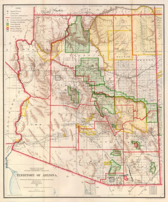
A colorful and fascinating map that provides a detailed look at the territory just seven years before statehood. The extent of nine Indian reservations and three Military reservations, including Fort Apache, and numerous National Forest Reserves are clearly shown in different colors. Private claims, confirmed and unconfirmed, are outlined in red. The Grand Canyon Forest Reserve is shown. Brown hachured mountainous areas and blue waterways combine to provide great visual impact. Details include watershed, mountains, railroads, wagon roads, private claims, unsurveyed townships, etc. Drawn by Daniel O'Hare, and lithographed by the Norris Peters Co., Photo-Litho.
References:
Condition: A+
Fine example with bright color and crisp impression, folding as issued.