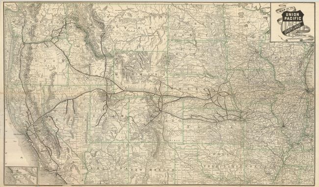
"Map of the Union Pacific The Overland Route and Connecting Lines", Rand McNally & Co.
Subject: Western United States
Period: 1889 (dated)
Publication:
Color: Printed Color
Size:
28.8 x 17 inches
73.2 x 43.2 cm
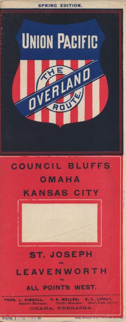
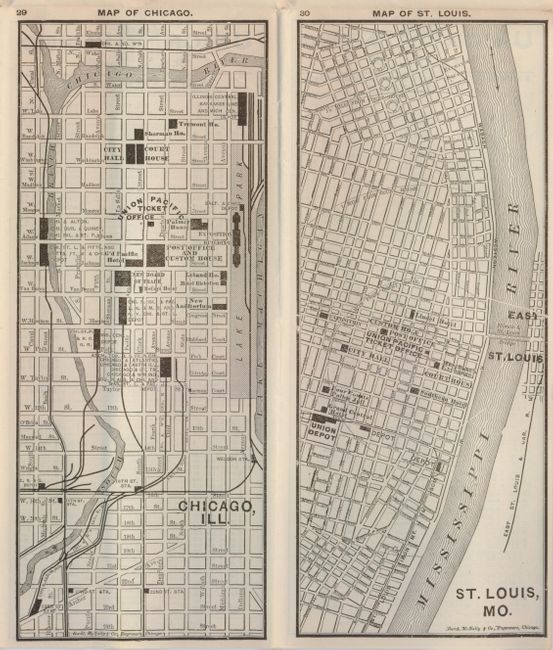
This is a folding map and timetable for the Union Pacific Railroad route. Originating in Kansas City, the rail routes flow west through Kansas, Colorado, Utah, Wyoming, and Idaho to the Pacific coast states. Each railroad is named with hundreds of rail stations located and likewise named. At lower left is a small inset showing the route of the Otay R.R. in Mexico with connections to San Diego and Ft. Yuma. On the map side is an eight panel section devoted to "Important Information" with facts on baggage and freight rates, steamship connections to Alaska, Asia and Australia, "Health and Pleasure Resorts," and information and rates on the Pullman's Palace Car. There are town plans of Chicago and St. Louis with an emphasis on rail stations and ticket office locations. This great piece of railroad ephemera has an extensive timetable on the verso of the map. The colorful timetable side features the Union Pacific shield. The timetable was printed by Rand McNally & Co. and is dated May 1st, 1889. This example has an additional pasted in sheet advertising the routes to "Tacoma, Seattle, Olympia, Port Townsend and Victoria." This blue advertising sheet precedes Washington's statehood by six months.
References:
Condition: B+
Clean and bright with a few fold intersection splits and one short marginal split, else near fine.