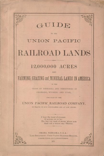
"Guide to the Union Pacific Railroad Lands…", Railroad Companies, (Various)
Subject: United States - Western & Central
Period: 1871 (dated)
Publication: Land Department Union Pacific Railroad
Color: Hand Color
Size:
5.8 x 8.5 inches
14.7 x 21.6 cm
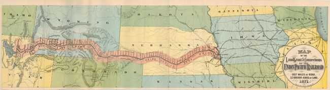
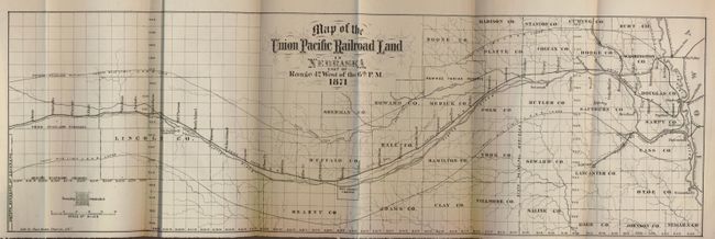
The title continues "12,000,000 Acres Best Farming, Grazing and Mineral Lands in America in the State of Nebraska and Territories of Colorado, Wyoming, and Utah for Sale by the Union Pacific Railroad Company, in Tracts to Suit Purchasers and at Low Prices." This scarce railroad promotional pamphlet is complete in original salmon printed wrappers. Issued only two years after completion of the railroad, this pamphlet announces the opening of additional land tracts in Western Nebraska, Wyoming, and Utah, after alerting the reader that "rich Government lands on the line of the railroad are rapidly settling," mostly in eastern Nebraska. To attract interest, "New and improved maps are inserted, and much valuable information given, designed to assist persons contemplating emigration." Of course, the information extols the many opportunities and advantages of buying railroad lands. Most interesting is the color Map of the Land Grant & Connections of the Union Pacific Railroad, 1037 Miles of Road, 12,000,000 Acres of Land, 1871 (27.5 x 7 inches) that stretches from Lake Michigan to the Great Salt Lake with the railroad and land grant belt extending from Omaha to Ogden. Settlements shown along the line are frequent and numerous, though the western lands were still largely unpopulated. Notations within the land grant belt, such as grazing lands, mineral lands, coal fields, and agricultural lands, beckon to the prospective emigrant. Topography is rather sketchy, but contains some quaint features, such as the Wind Rivir Mountains extending east-west like a great wall halfway across Wyoming. No wonder the railroad line stayed to the south! The second map is titled, Map of the Union Pacific Railroad Land in Nebraska east of Range 42 West of the 6th P.M. (20.7 x 6.5"). It details the route and the available land in Nebraska. Both maps were engraved by Charles Shober, Chicago, Ill. A scarce land promotional item in terrific condition.
References:
Condition: A
A little separation and faint soil on the paper covers, and some light damp stain of the text. The maps are fine.