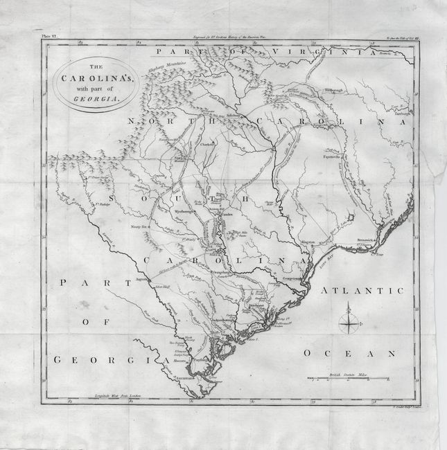
"The Carolina's, with Part of Georgia", Conder, Thomas
Subject: Southeastern United States
Period: 1790 (circa)
Publication: The History of ... the Independence of the United States.
Color: Black & White
Size:
14 x 13.6 inches
35.6 x 34.5 cm
An uncommon map of the Carolinas showing the routes of British and American forces during the Revolutionary War. It illustrates the routes of pursuit and retreat of the troops of Cornwallis, Greene, Lee and Stuart. The map shows forts, towns, ferry crossings, and battle sites. The topography is simple, and the Appalachians are referred to as the Alleghany Mountains, a term that was frequently used at this time for the whole range from Pennsylvania south to the Carolinas.
References: Mapforum.com #4, Carolinas Checklist, #140.
Condition: B+
A sharp impression issued folding and now flattened. The right binding side has a professionally repaired tear about 1" into map. There are a few minor spots in the map.