Catalog Archive
Auction 124, Lot 149

"The National Publishing Company's Railroad, Post Office, Township and County Map of Massachusetts, Rhode Island, and Connecticut", National Publishing Co.

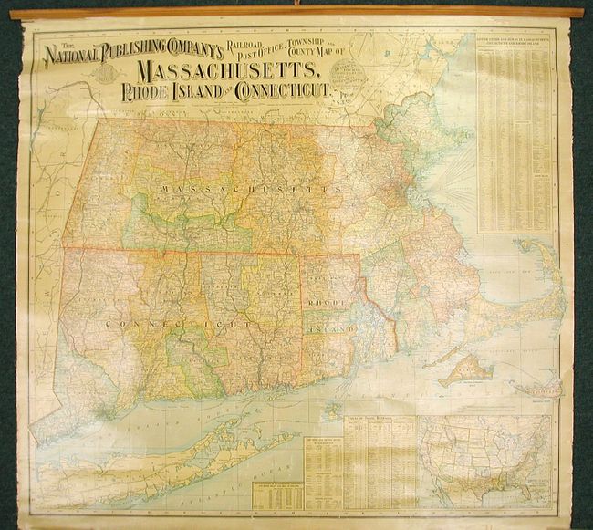
Subject: New England

Period: 1900 (dated)

Publication:

Color: Printed Color

Size:
37.3 x 34.5 inches
94.7 x 87.6 cm
Download High Resolution Image
(or just click on image to launch the Zoom viewer)

This colorful wall map extends from Portland, Maine to Long Island. It details the states of Massachusetts, Connecticut and Rhode Island. It is inset with a small map of the United States at lower right, and to the left of that are tables listing the counties and county seats, travel distances, and population. The table at upper right is a list of the cities and towns in the three states from the 1900 census.

References:

Condition: B+

The map presents well, and is clean and bright with good varnish. It is missing the ribbon edging on the side and the rail on the bottom, and it has a crack at the top. The washed out areas in the image are reflections from photography and are not on the map.

Estimate: $200 - $300

Sold for: $150

Closed on 5/7/2008

Archived