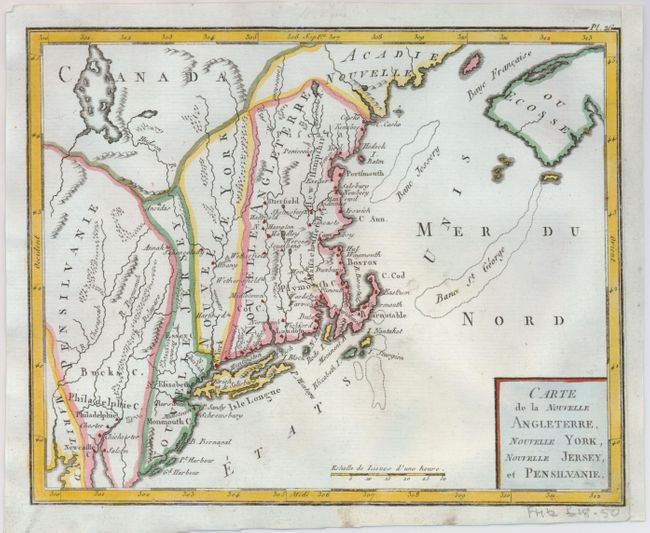
"Carte de la Nouvelle Angleterre, Nouvelle York, Nouvelle Jersey, et Pensilvanie", Bertholon, C.
Subject: New England
Period: 1799 (published)
Publication: Atlas moderne portatif
Color: Hand Color
Size:
8.5 x 6.8 inches
21.6 x 17.3 cm
This interesting map of New England exhibits some very odd boundaries. The states appear as an amorphous strip stretching north-south displaying the lack of French knowledge of the existing boundaries. The map is a close copy of Joseph La Porte's 1780 map of the same title, with a simplified cartouche and the change of Possessions Angloises in the Atlantic to Etats Unis reflecting the French support for American independence.
References: cf McCorkle #780.2.
Condition: B+
A nice impression with paper professionally and seamlessly added to the right binding side to facilitate framing. A small hole off Cape Cod has been infilled. There is some faint script on the verso that is the same approximate age as the map.