Catalog Archive
Auction 124, Lot 145

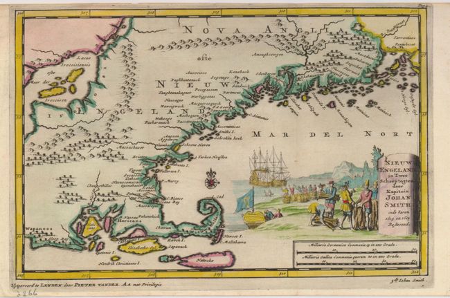
"Nieuw Engeland in Twee Scheepstogten door Kapitein Johan Smith in de Jaren 1614 en 1615", Aa, Pieter van der

Subject: Colonial New England

Period: 1707 (published)

Publication: Naaukeurige Versameling der Gedenk-Waardigste Zee…

Color: Hand Color

Size:
9.3 x 6 inches
23.6 x 15.2 cm
Download High Resolution Image
(or just click on image to launch the Zoom viewer)

This interesting map covering Rhode Island to Penobscot Bay in Maine uses cartography and names from John Smith's report of the area in 1614-15. It features a large Lacus Irocoisiensis with several large islands. The map is filled with many place names, both Indian and early colonial settlements. The Cape Ann peninsula is oddly shaped and named Tragabigzanda, the name given by John Smith in honor of a Greek maiden who was kind to him while he was held captive by Turks. Nantucket is named Natocke and Martha's Vineyard bears the name of Elizabeths Eyl. The delicately colored pictorial title cartouche depicts Captain John Smith trading with the natives, while his crew greet a mermaid in the background.

References: McCorkle #707-2.

Condition: A+

A nice example with narrow (1/8") top margin at top as issued.

Estimate: $800 - $900

Sold for: $550

Closed on 5/7/2008

Archived