"[Lot of 2] United States [and] Etats-Unis",
Subject: Eastern United States
Period: 1835 (circa)
Publication:
Color: Black & White
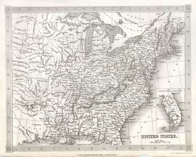
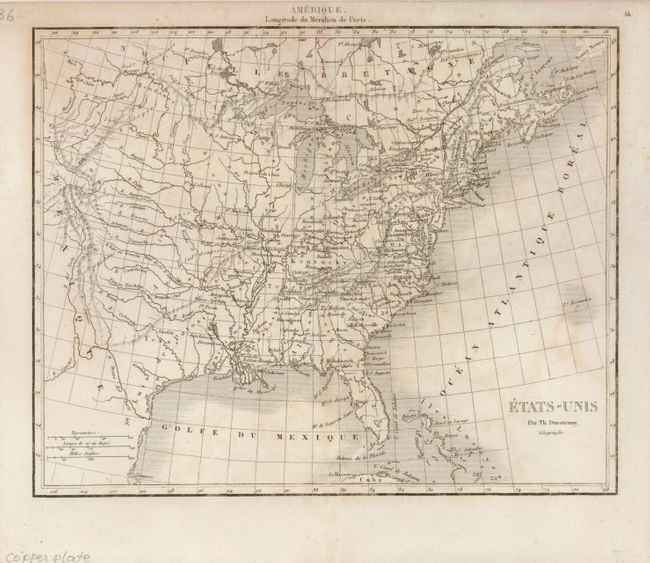
An attractive pair of maps showing the early United States as it began its westward expansion.
1) United States drawn and engraved by Alexander Findlay and published by Thomas Kelly in London. The map shows good topography and many place names. Florida is shown in an inset map in the lower right. A decorative border incorporates the latitude and longitude markers (9.5 x 7.5") .
2) Etats-Unis by Thunot Duvotenay. The map extends to Texas, which is also named as St. Louis de Potosi (8.8 x 7").
References:
Condition: B+
1) Professionally backed with tissue to repair a tear that enters just over 3" in the bottom of the map. 2) Faint irregular toning.