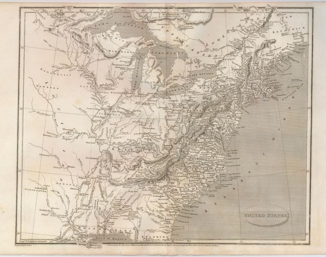
"United States", Arrowsmith, Aaron, Sr.
Subject: Eastern United States
Period: 1805 (dated)
Publication:
Color: Black & White
Size:
12.3 x 10 inches
31.2 x 25.4 cm
A detailed map of the early United States with Georgia Territory extending from the coast to the Mississippi River, the early state of Tenassee, and the District of Main. The forts, native villages, and frontier settlements are noted with Iowa Town and Lower Iowa Town named near the fork of the Des Moines (River Moin) and Mississippi rivers. The land west of the Mississippi has only native names and simple topography noted. Engraved by E. Jones and published by Longman, Hurst, Rees, Orme at Paternoster Row, London.
References:
Condition: A
A nice impression on a sound sheet with a little faint toning.