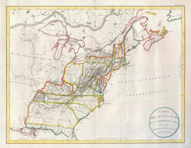
"Carte des Etats-Unis de l'Amerique-Nord pour Servir au Tableau du Climat et du Sol", Volney, C. F.
Subject: Eastern United States
Period: 1800 (circa)
Publication:
Color: Hand Color
Size:
21.4 x 16.5 inches
54.4 x 41.9 cm
This nicely engraved copper-plate map focuses on the United States but reaches into Canada to include the Maritimes. It extends westward to beyond the Mississippi River. Georgia encompasses all of present-day Alabama and Mississippi. There is an oddly shaped, unnamed region taking in present-day Ohio and West Virginia that we have not seen on any other map, and Maryland is also incorrectly portrayed. The map locates some Southeastern native tribes and gives the number of warriors in each; for example "Pays des Chactas (2000 Guerriers)." The map names major cities only, and simple topography is used to describe the landscape.
References:
Condition: B+
Issued folding, now flattened. There are a few light spots of foxing, still a good example.