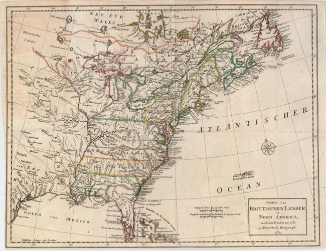
"Charte der Brittischen Laender in Nord America, nach den Frieden von 1763", Bell, Peter
Subject: Colonial United States and Canada
Period: 1772 (dated)
Publication: Geschichte der englishen Kolonien in Nord-Amerika
Color: Hand Color
Size:
15.3 x 11.6 inches
38.9 x 29.5 cm
This attractive and detailed map of the British Colonies describes the region according to the Treaty of 1763. The area reaches from James Bay to Newfoundland in the north and from the Gulf of Mexico to the Florida Keys in the south. The colonies of Virginia, the Carolinas, Georgia and Florida all extend to the Mississippi River. There is a large amount of coastal and interior detail with towns, Indian villages, rivers and fishing banks. This is a German edition of Bell's 1772 map, published in 1775.
References: McCorkle #772.1; Sellers & Van Ee #98 (British edition).
Condition: B+
A nice impression with original outline color. The left binding side and lower margin have been trimmed nearly to the neatline in the lower left corner. There is a small rust hole to the left of Lake Superior. Issued folding, now flattened.