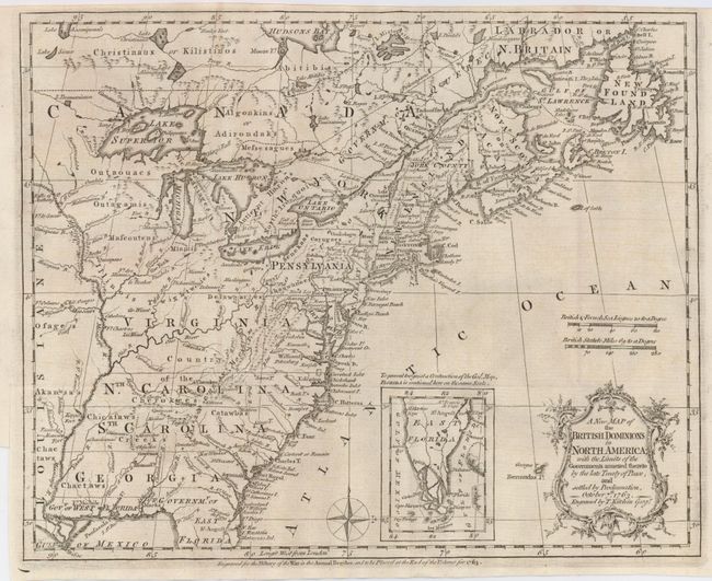
"A New Map of the British Dominions in North America; with the Limits of the Governments Annexed thereto by the Late Treaty of Peace, and Settled by Proclamation, October 7th, 1763", Kitchin, Thomas
Subject: Colonial United States and Canada
Period: 1763 (dated)
Publication: Annual Register
Color: Black & White
Size:
11.8 x 9.4 inches
30 x 23.9 cm
This very historical map illustrates the British colonies after the Treaty of Paris that marked the end of the French and Indian War in America. The treaty ended French colonial ambitions in North America with minor exceptions. Spain ceded east and west Florida to Great Britain, France relinquished title to the Louisiana Territory to Spain, and the British - Spanish boundary was established at Mississippi River. The map reflects the claims of the southern colonies that their charters extended to the Mississippi River. Also of interest are the names and locations of many Indian tribes and nations located away from the more populated areas of English settlements. An inset of East Florida on the same scale lies between the coastline and the decorative title cartouche.
References: Jolly ANNREG-3; McCorkle 763.5; Sellers & Van Ee 103.
Condition: A
A nice dark impression on a sheet with a close (1/8") margin at top as issued. Left binding side margin trimmed as usual with a tiny tear not affecting the map.