Catalog Archive
Auction 123, Lot 98

"Totius Americae Descriptio", Campanius Holm, Tomas

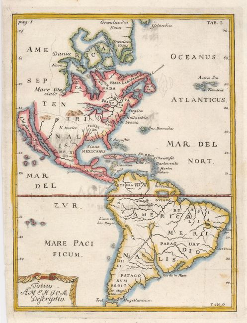
Subject: Western Hemisphere

Period: 1702 (circa)

Publication: Kort Beskrifning om Provincien nya Swerige…

Color: Hand Color

Size:
5.5 x 7.4 inches
14 x 18.8 cm
Download High Resolution Image
(or just click on image to launch the Zoom viewer)

An uncommon little map of the Americas showing California as an island on the Briggs model with a flat northern coast. This map was included in the first printed account of the colony of New Sweden on the Delaware River, published by Tomas Campanius Holm. The work was based the records left by his grandfather Johannes Campanius, chaplain of the Swedish colony from 1643 to 1648, and on the manuscript of the writer and settler Peter Mårtensson Lindeström, Geographia Americae. New Sweden (N. Suecia) is one of the few names noted on the map, along with Mont Royal (Montreal), N. Hollandia (New York), Virginia, and Florida. South America is shown with the mythical, equatorial Lake Parime, although it is not named here.

References: McLaughlin #149.

Condition: B+

A dark impression with a few faint printer's smudges.

Estimate: $550 - $650

Unsold

Closed on 2/20/2008

Archived