Catalog Archive
Auction 123, Lot 881

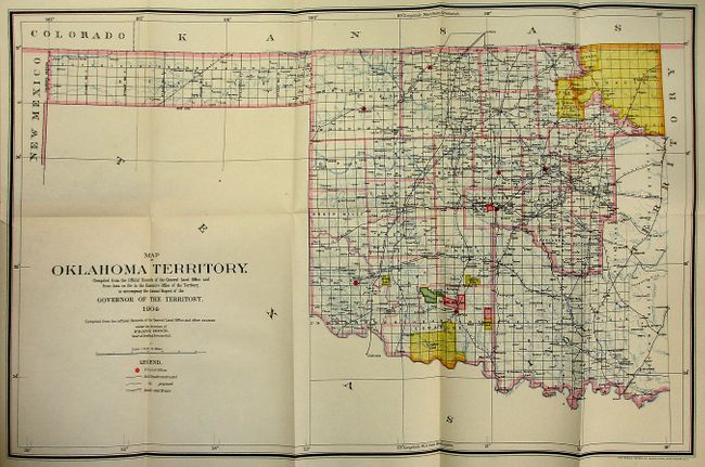
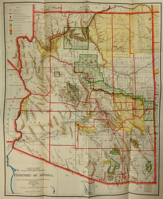
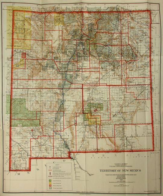
"Annual Reports of the Department of the Interior for the Fiscal Year Ended June 30, 1904. Miscellaneous Reports. Part II. Governor of Arizona. Governor of New Mexico. Governor of Oklahoma", U.S. Gov't Printing Office

Subject: Miscellaneous Books

Period: 1904 (published)

Publication: HR Doc. No. 5, 58th Congress, 3d Session

Color:

Size:
6 x 9.3 inches
15.2 x 23.6 cm
Download High Resolution Image
(or just click on image to launch the Zoom viewer)

Part two of this interesting and informative group of reports bound together comprising the Annual Reports of the Department of the Interior for 1904. Together they are well illustrated with black and white photography and nicely engraved maps. The reports are as follows:

Report of the Governor of Arizona. This report features the 1903 edition of the General Land Office's map of the Territory of Arizona, a colorful and wonderfully detailed map of the territory. The map includes information of the Indian, Forest and Military Reservations, land grants, and even large ranches. Folding as issued. The map has vivid printed color, and excellent detail of the region nine years before statehood. Grade A+.

Report of the Governor of New Mexico includes a pair of interesting charts showing precipitation and winds for the year 1903. This report also features the 1903 edition of the General Land Office's map of the Territory of New Mexico, a colorful and fascinating map that shows in great detail the extent of existing Indian reservations, Military reservations, Forest Reserves and Private Land Grants through color and hash. Mountains shown by a brown hachure, plus all the other colors on the map combine to provide great visual impact. Filled with information on watershed, mountains, railroads, wagon roads, unsurveyed townships, etc. The short-lived county of Leonard Wood is delineated; in 1903 Guadalupe county was renamed Leonard Wood and then returned to Guadalupe in 1905. The map was compiled by Frank Bond, Chief of Drafting Division. Map has a short binding tear, else fine. Grade A.

Report of the Governor of Oklahoma includes a group of interesting charts showing precipitation, temperature and winds for the year 1903. This report also features the 1904 edition of the General Land Office's Map of Oklahoma Territory , an attractive map with great attention paid to detail, including railroads constructed and proposed, as well as roads and trails. The map covers present day western Oklahoma with the panhandle, but only the western portion of what was then Indian Territory is shown. Indian reservations within the territory are shown, including the Osage, Kansas, Poncas, Otoes and Missourias. Land Offices are located at Woodward, Alva, Enid, Perry, Guthrie, Kingfisher, Ft. Reno, Oklahoma City, Mangum and Lawton. Map has bright printed color, and has a short binding tear not reaching the neatline. Grade A+.

Hardbound in original calf with gilt title on red, green and black bands on spine. 8vo, 712 pages. With the three original GLO territory maps, often missing from these volumes.

References:

Condition: A

Maps and text very good to excellent. Covers are lightly scuffed, and there is a short split between the front cover and spine.

Estimate: $350 - $450

Sold for: $250

Closed on 2/20/2008

Archived