Catalog Archive
Auction 123, Lot 610

"Tab. X. Europae, Macedoniam, Epirum ac Peloponnesum Repraesentans", Ptolemy/Mercator

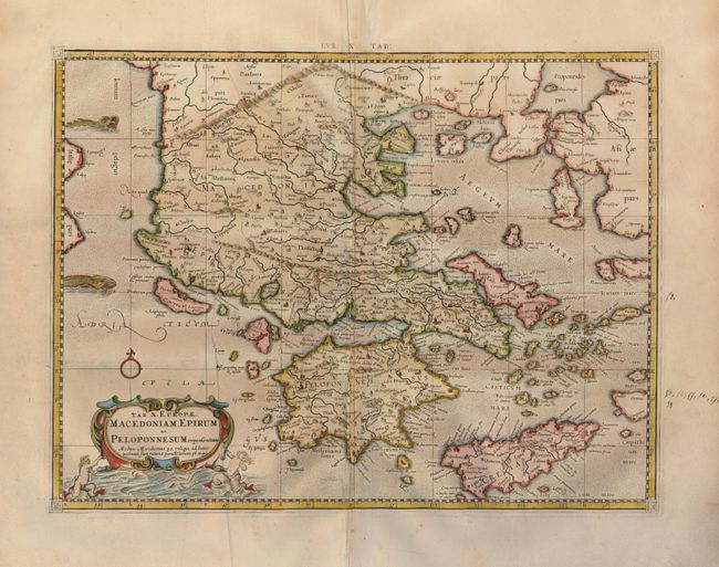
Subject: Greece and the Balkans

Period: 1730 (published)

Publication: Claudii Ptolemaei's Atlas Tabulae geographicae Orbis Terrarum

Color: Hand Color

Size:
17.6 x 13.4 inches
44.7 x 34 cm
Download High Resolution Image
(or just click on image to launch the Zoom viewer)

A beautiful map of the Balkan Peninsula, Greece, Crete and the Aegean islands. Mercator originally published this map in his 1578 edition of Ptolemy's great Geography. Although he is most renowned today for the projection he popularized and for first using the term Atlas for a collection of maps, he devoted much of his life to his Ptolemaic maps. The maps were beautifully engraved as nearly as possible to their original form and embellished with fine cartouches. This cartouche shows frolicking mer-people. This is from a 1730 edition.

References: Mickwitz & Miekkavaara, (Nordenskiold-2) #235-28.

Condition: A

A nice impression on strong laid paper with a printer's crease on the left. The right margin has an ink notation in an old hand, not affecting the map.

Estimate: $350 - $450

Sold for: $350

Closed on 2/20/2008

Archived