Catalog Archive
Auction 123, Lot 545

"Tab. II. Europae, Hispaniam ac Lusitaniam Complectens", Ptolemy/Mercator

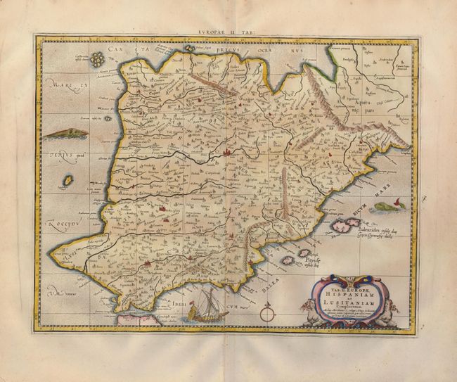
Subject: Spain & Portugal

Period: 1730 (published)

Publication: Claudii Ptolemaei's Atlas Tabulae geographicae Orbis Terrarum

Color: Hand Color

Size:
17 x 13.2 inches
43.2 x 33.5 cm
Download High Resolution Image
(or just click on image to launch the Zoom viewer)

An attractive Ptolemaic map of the Iberian Peninsula. Mercator originally published this map in his 1578 edition of Ptolemy's great Geography. Although he is most renowned today for the projection he popularized and for first using the term Atlas for a collection of maps, he devoted much of his life to his Ptolemaic maps. The maps were beautifully engraved as nearly as possible to their original form and embellished with fine cartouches. This one is flanked with two bare-breasted sphinxes, and the sea is adorned with a ship and a pair of sea monsters, one of whom looks like a dog with fur and floppy ears.

References: Mickwitz & Miekkavaara, (Nordenskiold-2) #235-20.

Condition: A

A nice impression on a sheet of fine laid paper. The margins have a little toning and a couple of creases, not affecting the map.

Estimate: $275 - $350

Sold for: $200

Closed on 2/20/2008

Archived