Catalog Archive
Auction 123, Lot 369

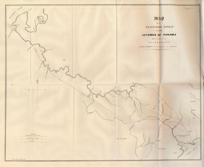
"Map of a Carriage Road in the Isthmus of Panama Drawn by Order of the Government…", U.S. Government

Subject: Panama

Period: 1838 (published)

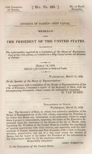
Publication: HR Doc. No. 228, 25th Congress, 2d Session

Color: Black & White

Size:
18.5 x 15 inches
47 x 38.1 cm
Download High Resolution Image
(or just click on image to launch the Zoom viewer)

This map and report reflect a very early and virtually unknown American interest in what became the Panama Canal. The map was prepared by Maurice Falmark, 2nd Commandant of Engineers. It shows Panama City at lower right with the projected road running northwest to Lemon Bay near Charges, today's Colon. The map is still bound in the original report "Isthmus of Darien - Ship Canal. Message from the President of the United States." This 103-page government document describes Charles Biddle's survey of Panama at the order of President Jackson. The various reports and memos are transmitted by John Forsyth, Department of State to President Van Buren.

Beginning in 1824 Emperor Iturbide was over-thrown, leading to the secession of the Central Americans from Mexico. The government of the new Federal Republic of the United Provinces of Central America understood the importance of a canal, which they expressed in a law passed in 1825 that provided for a canal to be built along the old Spanish route. The Central American minister in Washington, Antonio José Canaz, proposed in a letter to Secretary Henry Clay that North American merchants be invited to contribute capital for the enterprise. This letter, fully in Spanish, is part of this report. Clay agreed to the proposal, but his charge d’affaires in Central America did not share his enthusiasm and failed to provide the requested plan. The government of Central America grew impatient and took matters into their own hands, negotiating with Aaron Palmer and de Witt Clinton of New York. A syndicate, which included two members of Congress, was formed with the intention of raising $5,000,000. This effort failed. The story then changes to Simon Bolivar and his belief in the importance of an international canal to his new state of Gran Columbia, later called New Granada. His treaty of amity, commerce, and navigation was signed with the North Americans in 1825. Bolivar then invited the numerous nations to meet at Panama to discuss the canal. The ill feeling U.S. President Adams harbored toward the peoples of the region, coupled with a hostile Congress made the attendance by the U.S. an uncertain thing. Eventually agreeing to attend, the conference turned out to be a fiasco for the United States on several levels, including the death of the lead American minister, Richard Anderson while en-route from Bogota. Thus this early effort to create the canal ended in failure.

References:

Condition: B+

The map is folding, as issued. It has a few small spots, else fine. The report has a mixture of clean, bright pages and other with even age toning.

Estimate: $120 - $180

Sold for: $65

Closed on 2/20/2008

Archived