Catalog Archive
Auction 123, Lot 350

"Wyoming", U.S. Government
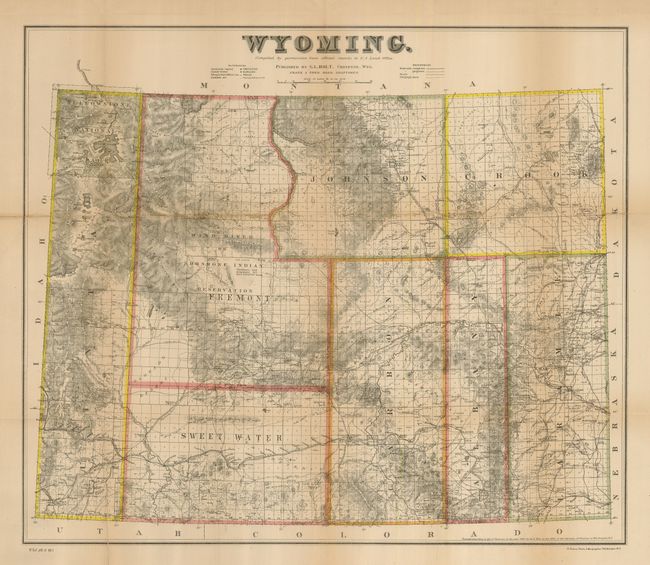
Subject: Wyoming

Period: 1883 (dated)

Publication: HR Doc. 1, Plt 5, 49th Congress, 1st Session

Color: Printed Color

Size:
24 x 20.5 inches
61 x 52.1 cm
Download High Resolution Image
(or just click on image to launch the Zoom viewer)

This is the first government edition of this rare map of Wyoming, drawn by Frank & Fred Bond, the one of the first to significant detail in the territory. Eight counties are delineated and Cheyenne is shown as the territorial capital. The Wind River or Shoshone Indian Reservation is located in the center of Fremont County. Shows the early settlement including ranches and trails. A note lists the number of acres of the reservation and the populations of the Shoshone and Arapahoe tribes. Yellowstone National Park is at upper left. Stagecoach lines, telegraph and telephone lines, roads, railways, forts and mines are also shown. Wheat lists 1884 and mentions an 1888 re-issue, but not this 1883 edition. He says the map's detail is impressive and is good tool for study of early Wyoming. Later maps were printed by G.W. & C.B. Colton and featured vignettes showing cattle ranching and early manufacturing to the sides of the title. This early edition was printed by the N. Peters Company of Washington, DC and is without the vignettes. An important and rare issue.

References: Wheat (TMW) #1302 (1884 ed.); Blevins, Mapping Wyoming #426; Rumsey #6490.

Condition: B

Some fold separations and edge tears have been expertly repaired with archival tape and are nearly unnoticeable. One closed tear enters Yellowstone and some toning along folds. Shows much better than condition would suggest.

Estimate: $500 - $700

Sold for: $550

Closed on 2/20/2008

Archived