Catalog Archive
Auction 123, Lot 344

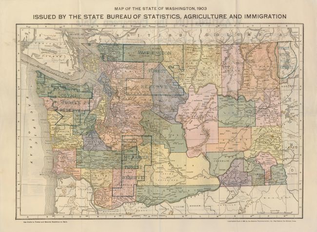
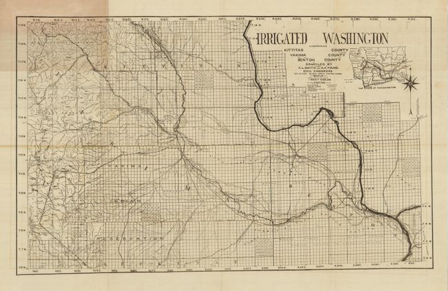
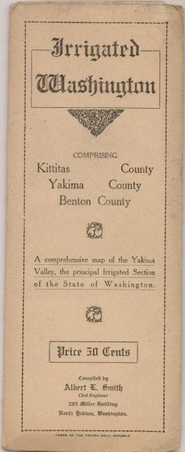
"[Lot of 2] Map of the State of Washington, 1903 Issued by the State Bureau of Statistics, Agriculture, and Immigration [and] Irrigated Washington Comprising Kittitas County Yakima County Benton County Compiled by A.L. Smith and A.A. Young",

Subject: Washington

Period: 1902-09 (dated)

Publication:

Color:

Size:
See Description
Download High Resolution Image
(or just click on image to launch the Zoom viewer)

The first map is an uncommon promotional map issued by the state. The map is colorful as it delineates the various counties and forest reserves. On verso is an index to towns and villages with population and promotional text. Includes "Washington Offers Better Opportunities to investors and homeseekers than any other part of the Untied States"; "Some of Its Advantages: The Finest Climate in America. No Crop Failures. The Best Timber in the World." and more equally inviting hyperbole. Printed by the Kenyon Printing & Mfg. Co., Des Moines, 1902, printed color. (16.5 x 11.3") Folding as issued. Very good condition with full margins and fine color.

The second is a black and white folding pocket map in its original paper covers. Published by the Press of the Yakima Daily Republic, Yakima, 1909. This detailed map is printed on thin, fine banknote paper. Centered on Yakima, it extends to show fine detail of the three-county region including watershed, survey status, villages, wagon roads, railroads, artesian wells, springs, canals, land by crop and much more. Inset map of the entire state lies within title area. Advertisement on back cover is for the "State Print Co. Map Makers, North Yakima, Wash." They offer city maps of Kennewick, Yakima, Toppenish and other regional towns. We've never before seen this map maker. (32.8 x 19.5") Condition B+ with a couple fold intersection splits and a little light offsetting. Covers very good.

References:

Condition:

See individual descriptions.

Estimate: $100 - $150

Sold for: $70

Closed on 2/20/2008

Archived