Catalog Archive
Auction 123, Lot 299

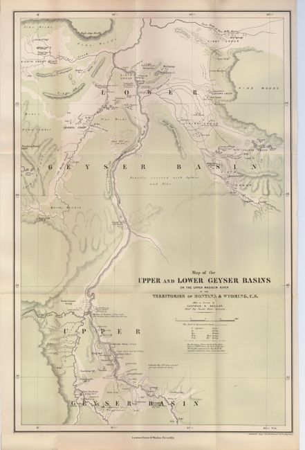
"Map of the Upper and Lower Geyser Basins on the Upper Madison River in the Territories of Montana & Wyoming, U.S.", Bechler, Gustavus R.

Subject: Montana, Wyoming

Period: 1876 (published)

Publication: The Great Divide: Travels in the Upper Yellowstone in the Summer of 1874

Color: Printed Color

Size:
13.5 x 20.7 inches
34.3 x 52.6 cm
Download High Resolution Image
(or just click on image to launch the Zoom viewer)

Attractive map of the geysers in these two major geyer basins of Yellowstone. This scarce map was produced according to a survey by Bechler, the Chief Topographer from the Snake River Division. It includes the tracks of the Earl of Dunraven, a British aristocrat who visited the area in 1874, and later published the source book for this map. The topography is shown by hachure and green ink shows land that is "densely covered with Spruce and Pine". Below the title, a note states the junction of the Iron Creek and Fire Hole River has an elevation of 7310 feet above sea level. The map locates nearly a dozen geyser groups, craters, hot springs, mud springs and the Old Faithful Geyser. A scarce issue.

References: Blevins Mapping Wyoming #383.

Condition: A

A few, short fold separations have been repaired with archival tape on verso, and some minor toning in margins.

Estimate: $200 - $250

Sold for: $300

Closed on 2/20/2008

Archived