Catalog Archive
Auction 123, Lot 276

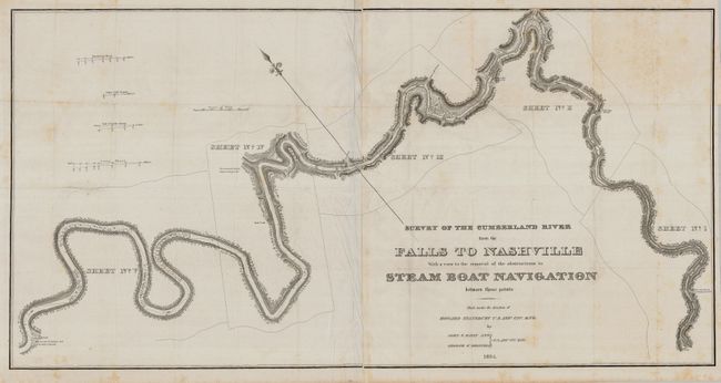
"Survey of the Cumberland River from the Falls to Nashville with a view to the removal of the obstructions to Steam Boat Navigation between those points", Stansbury, M. Howard (Capt.)

Subject: Kentucky and Tennessee

Period: 1834 (dated)

Publication: HR Doc 171, 23rd Congress, 2nd Session

Color: Black & White

Size:
45 x 23 inches
114.3 x 58.4 cm
Download High Resolution Image
(or just click on image to launch the Zoom viewer)

This scarce map shows the route from below Barboursville, Kentucky to the confluence of the Cumberland River and the Great South Fork, just above Nashville. This survey was done to clear the Cumberland and open the route to make it more navigable for steamboats. This map includes four cross sections titled: Shadowen's Shoal, White Cliff Ripple, End of Smith's Shoals, and Long Shoal. It is decorated with an elaborate compass point and terrific lettering in the title, which exactly matches the fancy lettering used on steamboats. This is an early work by Stansbury, who eighteen years later commanded an important expedition to Utah. A large (two-sheets joined) and early map that is very uncommon.

References: Claussen & Friis #43.

Condition: B

Folds as issued and a couple of tiny holes at the center and some creases and toning at folds.

Estimate: $200 - $250

Sold for: $140

Closed on 2/20/2008

Archived