Catalog Archive
Auction 123, Lot 264

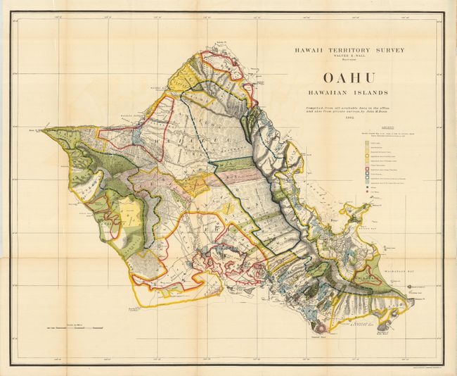
"Hawaii Territory Survey - Oahu Hawaiian Islands", Hawaii Territorial Surveys

Subject: Hawaii

Period: 1902 (dated)

Publication:

Color: Printed Color

Size:
33 x 27 inches
83.8 x 68.6 cm
Download High Resolution Image
(or just click on image to launch the Zoom viewer)

A brilliantly colored and detailed map of Oahu with much information on pineapple and sugar plantations, homesteads, public lands, Crown lands and public buildings. The areas of Diamond Head, Koko Head and Kailua Bay are described, as well as the Cocoa-Nut Grove on Maunaloa Bay, complete with tiny coconut trees. Hawaii's monarchy was overthrown in 1893, and this map was prepared for the Governor's Annual Report of 1906. The governor at this time was George R. Carter. Compiled by John M. Donn "from all available data in the office and also from private surveys."

References:

Condition: B+

Very nice example with a little fold toning, mostly in blank areas. Originally issued folding, this example is backed with archival tissue. Fine, strong coloring and original margins.

Estimate: $300 - $400

Sold for: $200

Closed on 2/20/2008

Archived