Catalog Archive
Auction 123, Lot 245

"Defenses of Washington. Extract of Military Map of N. E. Virginia Showing Forts and Roads", U.S. Government

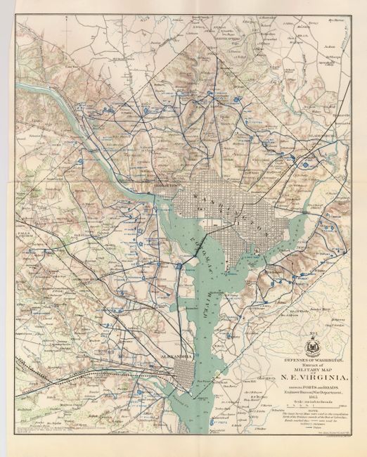
Subject: District of Columbia

Period: 1865 (dated)

Publication: Official Atlas of the Civil War

Color: Printed Color

Size:
13 x 16.3 inches
33 x 41.4 cm
Download High Resolution Image
(or just click on image to launch the Zoom viewer)

This most interesting map details the various defenses poised to defend Washington from the Confederate Army during the Civil War. The map extends to include Alexandria, Falls Church, Silver Spring, and Bladensburg. With remarkable detail, the map locates forts, schools, mills, railroads, fortifications, and much more. There are scores of individual homes and farms located with the owner's name. Washington is shown in street grid plan format. There is fine detail of watershed and topography. Dated 1865, but published 1891-95. The map was published to accompany the "report of Brig. Gen. Richard Delafield…dated October 30, 1865." This is one of the more desirable maps from the report.

References:

Condition: A+

Fine example with full margins, fine color and very crisp impression. Folding as issued.

Estimate: $150 - $200

Sold for: $450

Closed on 2/20/2008

Archived