Catalog Archive
Auction 123, Lot 234

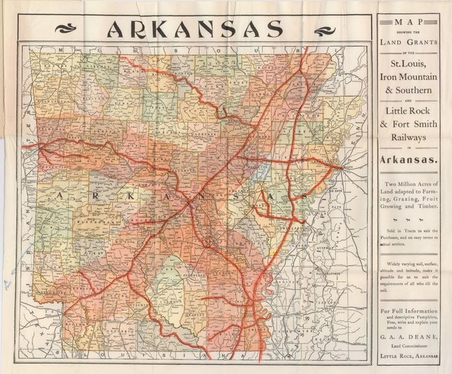
"Map Showing the Land Grants of the St. Louis, Iron Mountain & Southern and Little Rock & Fort Smith Railways in Arkansas",

Subject: Arkansas

Period: 1896 (circa)

Publication:

Color: Printed Color

Size:
15.8 x 13.2 inches
40.1 x 33.5 cm
Download High Resolution Image
(or just click on image to launch the Zoom viewer)

An uncommon promotional pocket map that folds into pictorial wrappers. The map is colorful and beautifully printed by the press of A.N. Kellogg Newspaper Co., Little Rock. The right panel is devoted to promoting the land grants of the railroads: "Two million acres of land adapted to farming, grazing, fruit growing and timber…on easy terms to actual settlers," etc. Map is dated by county development; specifically the 1900 gain in land by Lafayette from Columbia is not shown, while most of the 1895 changes are noted. Cover features early Art Nouveau-style design. The back cover has a fabulous bit of marketing with an engraving of a bighorn steer and the text "'Steer' for Arkansas via the Iron Mountain Route." A scarce land promotional piece.

References:

Condition: A

Map is fine less a blue pencil line marking route at left portion of map. Covers are also near fine less faint owners signature on front cover above in blank area.

Estimate: $100 - $150

Sold for: $50

Closed on 2/20/2008

Archived