Catalog Archive
Auction 123, Lot 128

"Plan de la Baye de Chibouctou nommee par les Anglois Halifax. No. 28", Bellin, Jacques Nicolas
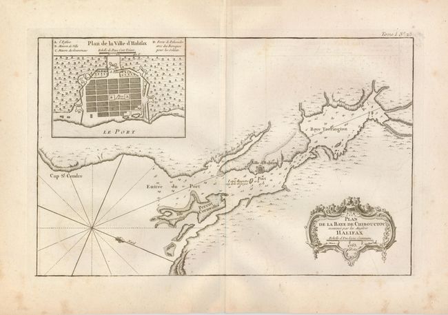
Subject: Canada

Period: 1764 (published)

Publication: Le Petit Atlas Maritime

Color: Black & White

Size:
13.8 x 8.7 inches
35.1 x 22.1 cm
Download High Resolution Image
(or just click on image to launch the Zoom viewer)

Attractive copper engraved chart of the vicinity of Halifax from Chebucto Head to the head of Bedford Basin, naming the Baye Torrington, Cap St. Cendre, Isle Perrot Cornwallis, etc. Soundings and anchorages are noted in the harbor. The fleur-de-lys aligns north to the right. Fine inset plan of Halifax clearly shows the surrounding fortifications, locates the Governor's Mansion and more. A most decorative rococo-style title cartouche balances the design. A very early plan of Halifax.

References: Kershaw #826; Sellers and Van Ee #460.

Condition: B+

The map has a trace of offsetting in blank areas opposite the cartouche and plan. It is on thick hand laid paper with wide margins and large watermark.

Estimate: $150 - $250

Sold for: $210

Closed on 2/20/2008

Archived