Catalog Archive
Auction 122, Lot 99

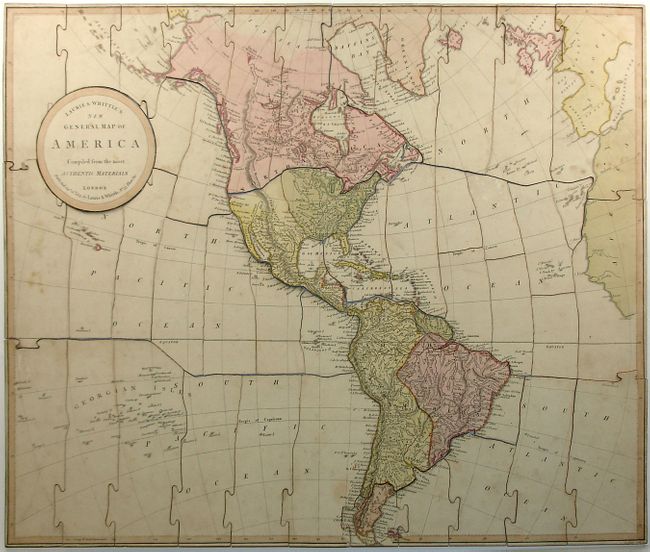
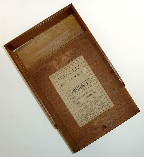
"Laurie & Whittle's New General Map of America Compiled from the Most Authentic Materials (Wallis's New Dissected Map of America)", Wallis/Laurie & Whittle

Subject: Puzzle map of the Americas

Period: 1813 (dated)

Publication:

Color: Hand Color

Size:
23 x 19.3 inches
58.4 x 49 cm
Download High Resolution Image
(or just click on image to launch the Zoom viewer)

This is a very unusual and complete John Wallis jigaw puzzle map of Laurie & Whittle's New General Map of America from 1813. It is in its original mahogany box decorated with the label signed by Wallis. Britain's claims in the Pacific Northwest come far into northern California, and the Stoney Mountains reach from Mexico north to the Arctic. South America shows the fictitious Lake Parime, just north of the Equator. Engraved by B. Smith.

Map games were a popular sideline for cartographic publishers from about 1760 onward in England, with John Bowles publishing the earliest geographical game in 1759. John Wallis Sr. and his son Edward began working together as mapsellers and publishers, and by the 1790s Wallis' business began to focus on map games, dominating the London market for such items. This business continued up to about 1850 with Edward succeeding his father around 1818. This example has a label that claims John Wallis is the original manufacturer of dissected maps and puzzles, claiming 30 years in the business.

References: Mapforum #10, pp 60.

Condition: B+

Superb condition for a map of this type with a small chip by Rio de Janeiro and some minor foxing. The mahogany box is intact even to the printed and signed label.

Estimate: $600 - $800

Sold for: $1,200

Closed on 12/5/2007

Archived