Catalog Archive
Auction 122, Lot 720

"Arabia, According to the Newest and Most Exact Observations", Moll, Herman
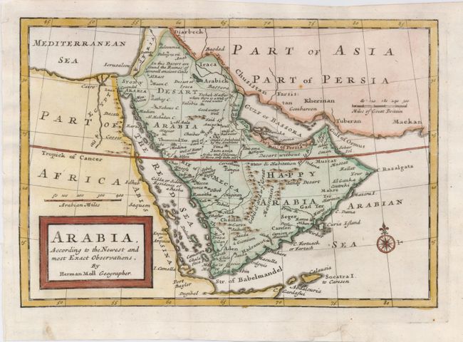
Subject: Arabia

Period: 1712 (circa)

Publication: Atlas geographus, or a Compleat System of Geography

Color: Hand Color

Size:
10 x 7 inches
25.4 x 17.8 cm
Download High Resolution Image
(or just click on image to launch the Zoom viewer)

By the early eighteenth century European knowledge of the coastlines of Africa and India had advanced considerably, and the interiors of these lands were beginning to take shape. However, the lack of navigable rivers made Arabia difficult to chart, and the locations of inland towns remained largely speculative. This map is a great example of this period when cartography was largely based on unreliable and often conflicting reports. It is filled with notations, particularly concerning water or the lack thereof. The Muslim pilgrimage route from Basra to Mecca is shown.

References: Tibbetts #209.

Condition: A

Some paper loss in bottom margin has been replaced, well away from map.

Estimate: $275 - $350

Sold for: $210

Closed on 12/5/2007

Archived