Catalog Archive
Auction 122, Lot 658

"Plan Topo-Hydrographique du Detroit de Gibraltar Dresse en Partie sur la Carte Hollandoise d'Henri Lynslager, avec des Details Interessans", Lattre, Jean

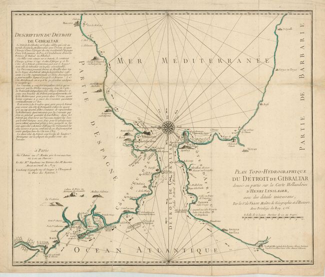
Subject: Mediterranean

Period: 1756 (dated)

Publication:

Color: Hand Color

Size:
20.8 x 17.6 inches
52.8 x 44.7 cm
Download High Resolution Image
(or just click on image to launch the Zoom viewer)

Based on the charts by Hendrik Lynslager, a Dutch navigator, this interesting sea chart details the Strait of Gibraltar, across to Ceuta on the Barbary coast, and extends to Cadiz and Malaga. A finely engraved compass rose orients the map with north to the left. Pictorial landmarks, anchorages, hazards, currents and soundings make this a wonderfully descriptive sheet. A lengthy description in French fills the upper left. The map credits de Vezou and was published by Lattre.

References:

Condition: B

A nice impression with some minor loss on the folds professionally reinstated using the paper leaf casting method and a tiny amount of facsimile. Issued folding, now flattened.

Estimate: $500 - $600

Sold for: $400

Closed on 12/5/2007

Archived