Catalog Archive
Auction 122, Lot 653

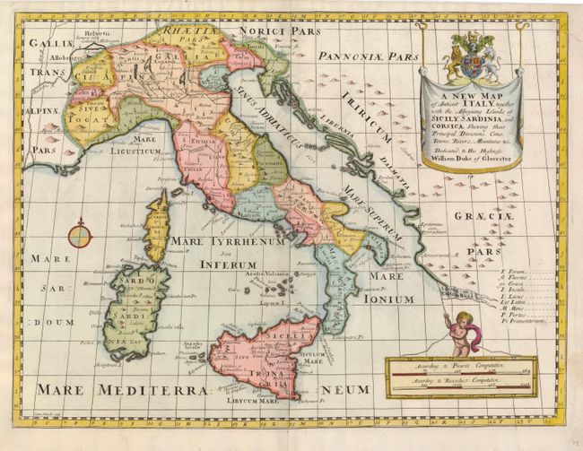
"A New Map of Antient Italy, together with the Adjoyning Islands of Sicily, Sardina, and Corsica, Shewing their Principal Divisions, Cities, Towns, Rivers, Mountains, &c.", Wells, Edward
Subject: Italy

Period: 1700 (circa)

Publication:

Color: Hand Color

Size:
19.3 x 14.5 inches
49 x 36.8 cm
Download High Resolution Image
(or just click on image to launch the Zoom viewer)

Richly colored map that illustrates the historical division of Italy. The map extends to the Adriatic coast, and includes the islands of Sicily, Sardinia and Corsica. This attractive map is decorated with a large, drape-style title cartouche displaying the royal crest, and a putto raises a flag above a pair of distance scales.

References:

Condition: B+

A dark impression on a sheet with a couple tiny wormholes and a repaired tear that just touches the upper right hand border.

Estimate: $250 - $350

Sold for: $375

Closed on 12/5/2007

Archived