Catalog Archive
Auction 122, Lot 544

"Carte Itineraire Physique Politique et Routiere de l'Espagne et du Portugal…", Fremin, A. R.

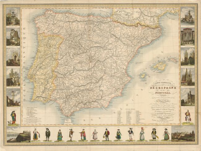
Subject: Spain & Portugal

Period: 1840 (circa)

Publication:

Color: Hand Color

Size:
27.8 x 20 inches
70.6 x 50.8 cm
Download High Resolution Image
(or just click on image to launch the Zoom viewer)

This extremely uncommon carte-a-figures map from the 19th century features the Iberian Peninsula and is surrounded with defly engraved figures and representations of places of note in Spain and Portugal. The vignettes flanking the map include Alhambra, Malaga, The Giralda Bell Tower of the Cathedral of Seville, Burgos Cathedral, Tower of Orangers in Seville, St. Nicholas's Tower in Cordova, the Carmel Convent, Madrid, Lisbon and El Prado in addition to others. The figures below the map include a bull fighter and typical attire for residents of various parts of Spain and Portugal. The map is filled with details of roads, towns and cities, as well as topography and was made as a folding map to assist travelers in the region.

References:

Condition: B+

Issued folding, now flattened, and without the covers. Tissue has been used to reinforce and repair some fold separations and a few marginal tears and loss. Lower right corner with a repaired tear just past the border.

Estimate: $400 - $500

Sold for: $425

Closed on 12/5/2007

Archived