Catalog Archive
Auction 122, Lot 330

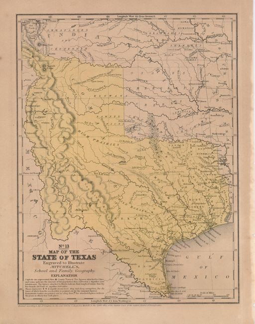
"No. 13 Map of the State of Texas", Mitchell, Samuel Augustus

Subject: Texas

Period: 1846 (dated)

Publication: Mitchell's School Atlas

Color: Hand Color

Size:
8 x 10.5 inches
20.3 x 26.7 cm
Download High Resolution Image
(or just click on image to launch the Zoom viewer)

This is the first edition of this map and is the first to name Dallas. This map features the "Stovepipe" configuration showing Texas at its largest extent when first admitted to the Union. The western boundary is at the Rio Grande del Norte, putting Santa Fe in Texas. Part of Texas continues to the northwest above Taos in an area labeled the Green Mountains. There are no counties formed west of about 98°, but there is a large unorganized Bexar region above San Antonio de Bexar and below a region labeled Wild Horses. In the west a number of Indian tribes are named. This is the most desirable map of Texas from the Mitchell school geographies.

References:

Condition: B+

A strong sheet with original color. There is some irregular toning, still it is a nice example.

Estimate: $400 - $500

Sold for: $500

Closed on 12/5/2007

Archived