Catalog Archive
Auction 122, Lot 293

"A New and Accurate Plan of the Town of Boston, in New England [on sheet with] A New Plan of Boston Harbor, from an Actual Survey", Anon.

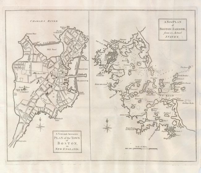
Subject: Massachusetts, Boston

Period: 1774 (published)

Publication: Universal Magazine

Color: Black & White

Size:
13.5 x 10.8 inches
34.3 x 27.4 cm
Download High Resolution Image
(or just click on image to launch the Zoom viewer)

This uncommon map was issued just prior to the outbreak of the Revolutionary War. It shows two maps on one sheet; one a plan of Boston, the other a view of the harbor. The city plan is well-detailed with graphic depictions of the Liberty Tree, Powder House and Beacon Hill. The Liberty Tree, an elm tree located at about Washington and Essex Streets, and used as a meeting place by the Sons of Liberty, a group formed after the Stamp Act of 1765. The tree was attacked by British Loyalists in 1775 and burned, but it remained a popular symbol encouraging other colonialists to erect Liberty poles that were hung with flags depicting the Liberty Tree. The harbor plan shows soundings and numerous islands, along with the city and several scattered settlements in the area.

References: Jolly, UNIV-172.

Condition: B

A dark impression on a sheet of fine laid paper with an elaborate watermark. The map on the right has a 4-1/2" repaired tear extending about halfway into the map, a small repaired hole and a crease in the title.

Estimate: $400 - $500

Sold for: $750

Closed on 12/5/2007

Archived