Catalog Archive
Auction 122, Lot 206

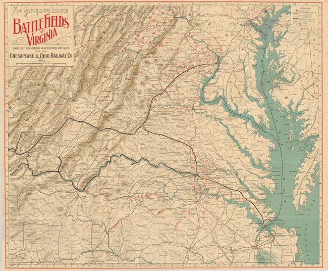
"Map Showing the Location of Battlefields of Virginia Compiled from Official War Records and Maps for the Chesapeake & Ohio Railroad Co.", Poole Bros.

Subject: United States - Mid-Atlantic

Period: 1891 (dated)

Publication:

Color: Printed Color

Size:
24.3 x 20 inches
61.7 x 50.8 cm
Download High Resolution Image
(or just click on image to launch the Zoom viewer)

This scarce railroad map details approximately 150 battlefields in Virginia, West Virginia and Maryland. The verso has a train schedule on one panel and an extensive description of Civil War history in the area. Hundreds of Civil War engagements are listed alphabetically. The map folds into pictorial self covers with one side promoting the 26th Annual Encampment of the G.A.R.

References:

Condition: A

A couple small intersectional fold splits repaired with archival tape on verso, else fine.

Estimate: $200 - $300

Sold for: $800

Closed on 12/5/2007

Archived