Catalog Archive
Auction 122, Lot 197

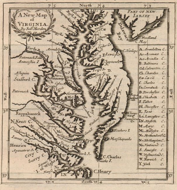
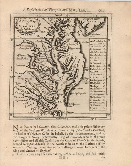
"A New Map of Virginia", Morden, Robert

Subject: Colonial Chesapeake Bay

Period: 1688 (published)

Publication: Geography Rectified

Color: Black & White

Size:
4.8 x 5 inches
12.2 x 12.7 cm
Download High Resolution Image
(or just click on image to launch the Zoom viewer)

This is the uncommon first state of this miniature map of Chesapeake Bay, accompanied by two sheets of very interesting related English text. This map replaces Morden's earlier map of the region that also named Maryland and is derived from the Thornton/Green map of 1678. A number of place names are within the map including several new ones, the most notable of which are Patomack Falls and Turky Bushard. A lettered key to the right names the counties. Despite its size, the map shows well-engraved coastal detail extending from the southern tip of New Jersey, Delaware Bay south to the James River.

References: Burden #651.

Condition: A+

A superb impression on clean laid paper. The text is also in excellent condition.

Estimate: $500 - $600

Sold for: $900

Closed on 12/5/2007

Archived