Catalog Archive
Auction 121, Lot 850

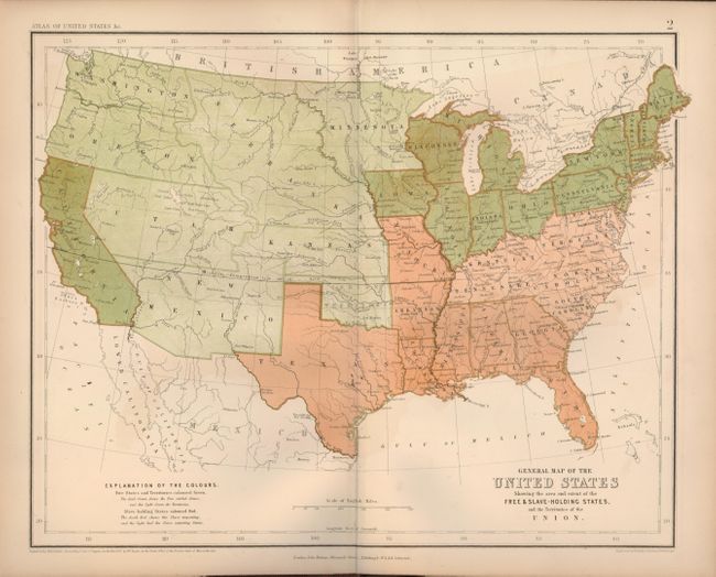
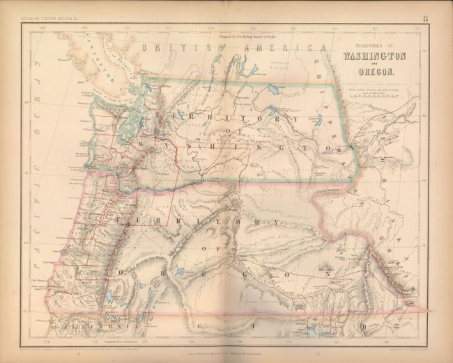
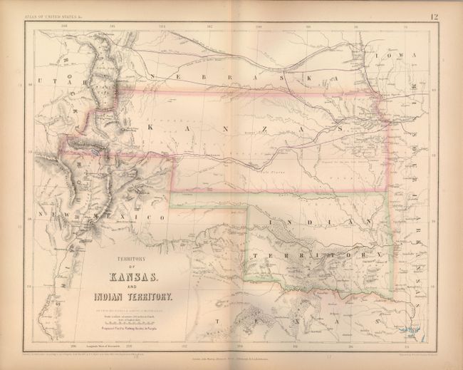
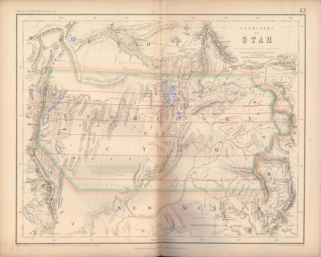
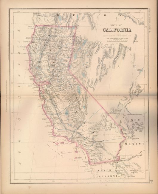
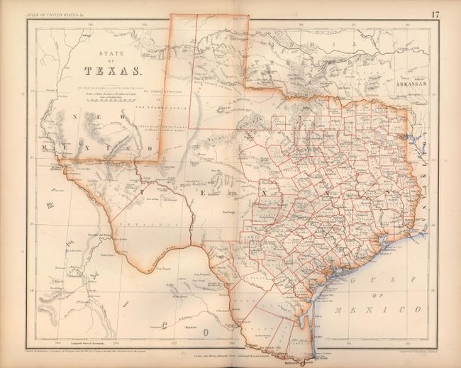
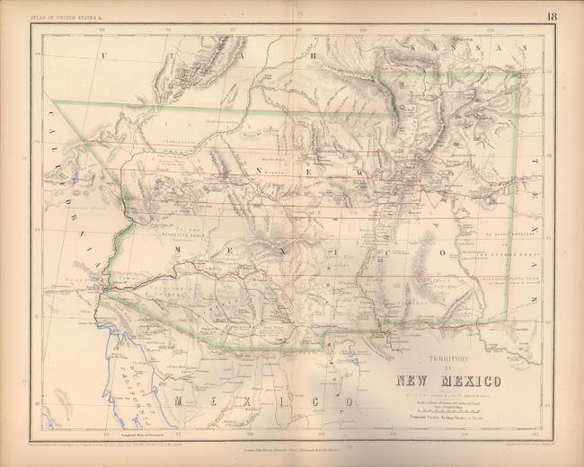
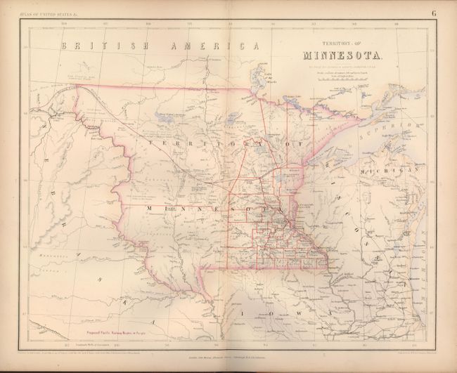
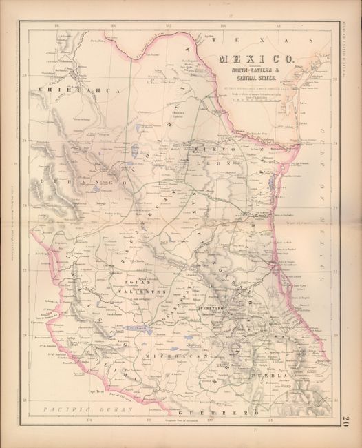
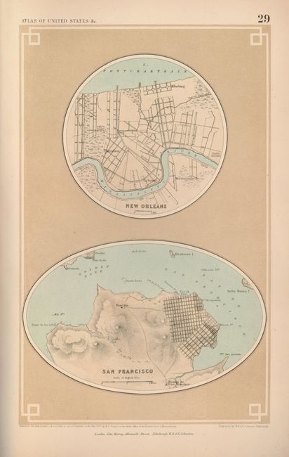
"Atlas of the United States of North America…", Rogers & Johnston

Subject: Atlases

Period: 1857 (dated)

Publication:

Color: Hand Color

Size:
10 x 14.5 inches
25.4 x 36.8 cm
Download High Resolution Image
(or just click on image to launch the Zoom viewer)

This fine atlas was a collaboration between the British cartographer Alexander Keith Johnston and the American geographer Henry Darwin Rogers. Their combined efforts produced one of the finest groups of U.S. maps in the 19th century. There are 23 expertly rendered double-page maps, each with a crisp engraving and a combination of hand and lithograph coloring. In the back of this terrific atlas are nine city plans printed on five sheets, and an additional, unlisted plan of the City of Charleston With its Harbour and Forts is pasted down inside the front cover. The General Map of the United States delineates "Free and Slave Holding States", and has a key explaining which states exported, and which imported slaves. The Territory of Nebraska is particularly eye-catching as it is tremendously detailed and encompasses the Dakotas, Montana and Wyoming. Other important maps in this atlas include the Territory of Minnesota that shows early county configurations, Territory of New Mexico with details including mines, Indian villages and ruins, and Territories of Washington and Oregon with numerous forts, Indian tribes and early development west of the Cascades. The Territory of Utah has a long note in the map, credited to Fremont's Report, discussing the Great Basin's elevation, topography and its numerous land-locked rivers and lakes. The inhabitants here are described as "savage tribes which no traveller has seen or described." This is certainly one of the rarest of all maps of the Utah Territory. The proposed route of the Pacific Railway is shown in purple and winds its way across the maps of the western U.S. Several of these maps appear in no other atlas, making this an exceptionally desirable example. Small folio. Complete. Rebound in brown cloth with original boards, decorative title in gilt on front.

References: Phillips (A) 3670; Wheat [TMW], Vol. IV, p.66.

Condition: A

Maps have some light toning along edges and centerfolds, and some minor offsetting on a few maps. Covers lightly rubbed and a bit sunned. Spine and binding sound and tight. A beautiful example of a rarely offered and important atlas.

Estimate: $6,000 - $7,000

Sold for: $5,000

Closed on 9/26/2007

Archived