Catalog Archive
Auction 121, Lot 60

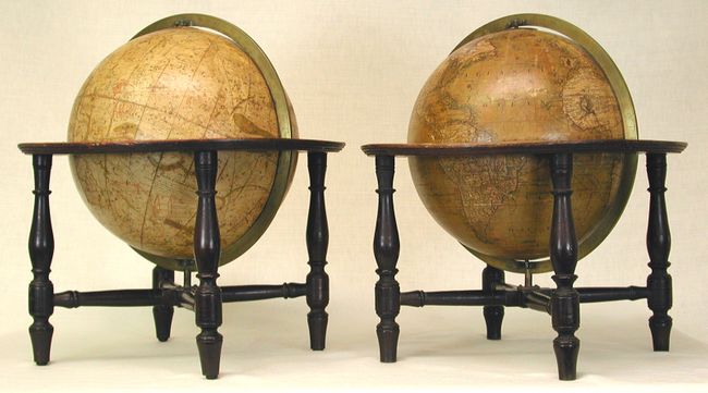
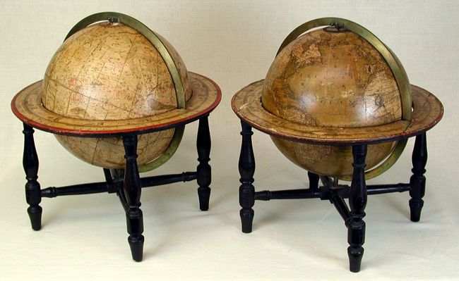
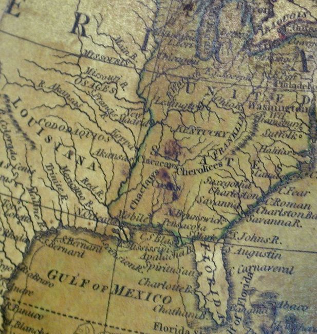
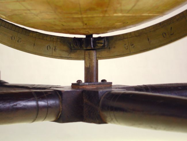
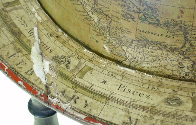
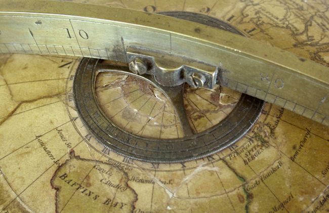
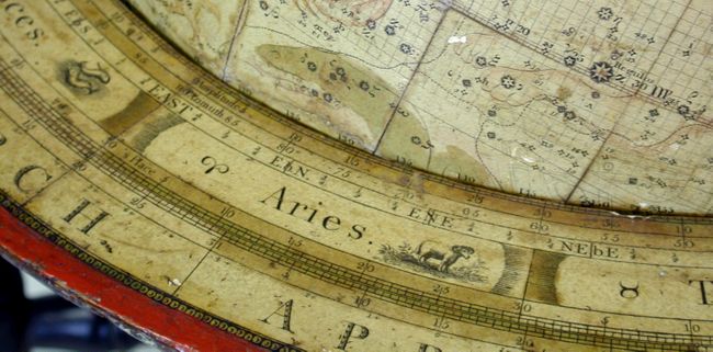
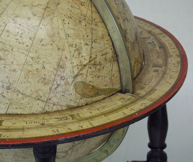
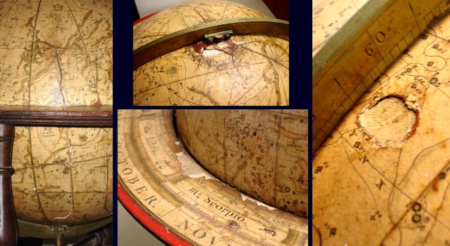
"[Lot of 2] The New Twelve Inch British Terrestrial Globe …[and] The New Twelve Inch British Celestial Globe…", Bardin, William & T. M.

Subject: Globes

Period: 1800-07 (dated)

Publication:

Color: Hand Color

Size:
12 x 12 inches
30.5 x 30.5 cm
Download High Resolution Image
(or just click on image to launch the Zoom viewer)

Extremely rare matched set of 12" terrestrial and celestial library globes. Each globe is about 19" in height, set in mahogany bases, with brass meridians and engraved horizon rings. These globes were made by William Bardin and his son, Thomas Mariott Bardin, and sold by W. & S. Jones, sellers of scientific instruments in London. Both globes have small labels of Jones affixed over the makers labels. The Bardin firm began making their "New British Globes" in 1798, and after T. M. Bardin's death in 1819, his daughter, Elizabeth Mariott Bardin continued the business under her married name of Edkins.

The New Twelve Inch British Terrestrial Globe Representing the Accurate Positions of the Principal Known Places of the Earth, from the Discoveries of Captain Cook and Subsequent Circumnavigators to the Present Period 1802 … With Addition to 1807 is based on John Arrowsmith. The most notable aspect appears in the young United States, where the short-lived, proposed State of Franklin appears in the region of present-day eastern Tennessee. Franklin was formed in the western part of North Carolina in 1784, by a group of "westerners" who felt cut-off from state government by the Appalachian Mountains. John Sevier was appointed as governor and they maintained a legislature for several years. Due to some fascinating political intrigue, Franklinia or Franklin was never recognized by Congress and eventually the region was re-annexed by North Carolina. The fledgling state appears on only a very few maps and this is the only globe we have seen with this designation. In the western part of North America the Stony Mountains reach from New Mexico to just shy of the Arctic Circle, and Texas is named as a province of Mexico. The tracks of the Pacific voyages of Captain Cook are noted with dates, concluding with a notation of his demise at the hands of natives in Karakooa Bay on February 14th, 1779. The interior of Africa is left nearly blank with no speculative cartography in the unexplored regions. The southern coast of Australia is incomplete, but Tasmania is correctly shown as an island.

The New Twelve Inch British Celestial Glove Containing the Exact Positions of more than 3800 Fixd Stars, Nebulae; Planetary Nebulae; &c; According to the Latest Discoveries and Observations of Dr. Maskelyne; Dr. Herschell, and other Eminent Astronomers and Adjusted to the Present Period of 1800. The delicately engraved skies are depicted with the larger constellations shown in allegorical form. In addition to the better-known constellations, the globe includes some lesser known ones, including Bootes, Corona Borealis, Canis Venatici, Camelopardalis, Perseus and the Head of Medusa. The southern hemisphere includes some uncommon names given by the French astronomer Abbé Nicolas Louis de Lacaille (1713-1762), including Equuleus Pictorius (Laicalle's Pictor), Fornax Chemica (Fornax), and the obscure Microscopium.

References: Tooley (Mapmakers) p. 84; Der Globusfreund, #41/42, Millburn and Rossaak, pp.21-57.

Condition: B

The terrestrial globe has a few cracks in the meridian with a small amount of paper loss, some minor abrasions and cracks, and a couple of small dents in the Atlantic and Africa. The brass point of attachment from the meridian to the base is broken, but it does not affect the globe's movement. The celestial globe has some minor cracks, some loss at the poles, old repaired cracks and a filled dent. The celestial does not move freely. The globes are presentable as is, but would benefit from minor professional restoration.

Estimate: $25,000 - $30,000

Unsold

Closed on 9/26/2007

Archived