Catalog Archive
Auction 121, Lot 596

"Rheinfels Petite Ville forte Situee sur une Hauteur au Bord Occidental du Rhein du Comte de Catzenellenbogen…", Fer, Nicolas de
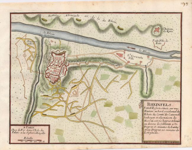
Subject: Germany

Period: 1696 (circa)

Publication: Les Forces de l' Europe…

Color: Hand Color

Size:
10.5 x 8 inches
26.7 x 20.3 cm
Download High Resolution Image
(or just click on image to launch the Zoom viewer)

This plan shows the fortress of Rheinfels near St. Goar, one of the largest castles on the Rhine. It illustrates the French siege of 1692 in which the Hessians, with a force of only 4,000 men, defended it against an army of 28,000 soldiers. Nicolas de Fer held the title of Geographer at Louis XIV's court. He was one of the most prolific publishers of plans of European cities in the late seventeenth century.

References: Pollak #21, p. 40.

Condition: B+

Nice impression on a sheet with a few spots of foxing.

Estimate: $70 - $100

Sold for: $40

Closed on 9/26/2007

Archived