Catalog Archive
Auction 121, Lot 519

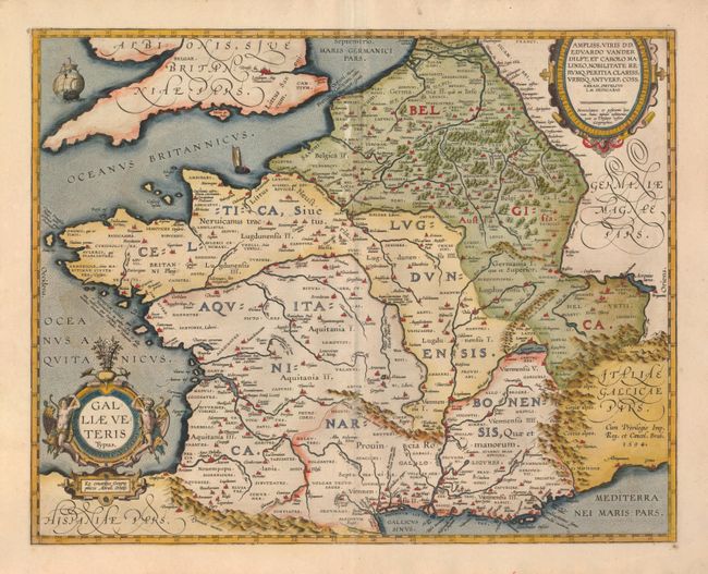
"Galliae Veteris Typus", Ortelius, Abraham
Subject: France

Period: 1595 (circa)

Publication:

Color: Hand Color

Size:
19.5 x 15.5 inches
49.5 x 39.4 cm
Download High Resolution Image
(or just click on image to launch the Zoom viewer)

A lovely map of France during Roman times based on ancient geographical sources including Strabo, Plinius, Virgilius, Ovidius and Caesar. The map is filled with detail and ancient place names. Two ships sail in the stipple engraved oceans and the map is decorated with two fine cartouches. Latin text on verso.

References: Van den Broecke #196.

Condition: B

Pretty original color on a strong sheet with some abrasion on the centerfold at top, and some discoloration in the sea caused by oxidization of the color opposite.

Estimate: $250 - $300

Sold for: $300

Closed on 9/26/2007

Archived