Catalog Archive
Auction 121, Lot 439

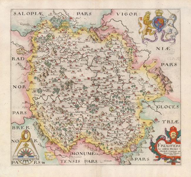
"Frugiferi ac Ameni Herefordiae Comitatus qui olim pars suit Silurum delineatio", Saxton/Hole

Subject: England

Period: 1607 (circa)

Publication: Britainnia

Color: Hand Color

Size:
12.3 x 11.2 inches
31.2 x 28.4 cm
Download High Resolution Image
(or just click on image to launch the Zoom viewer)

This beautiful map of the Hereford area is engraved with delicately rendered trees, mountains and towns. Malvern Hill is on the eastern edge of the map with Monmouth on south. Ludlow is located in the far northern part of the map and Brestayne and Hay border the west. The enchantingly-named Gilden Vale is noted in the southwestern portion of the map. This is now called the Golden Vale. The map is decorated with a strapwork cartouche, an elaborate wind rose within a compass and the crest of Britain featuring a lion and a unicorn.

References:

Condition: A

Lovely impression with an intricate watermark. There is a little faint offsetting in map and hinge remnants on verso.

Estimate: $200 - $275

Sold for: $150

Closed on 9/26/2007

Archived